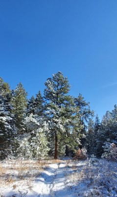
Carhart Trail
Carhart Trail is a 3.6 mile in and out trail through old forests with 338' of elevation gain. Park altitude is 7000'. It is an easy hike, a pleasant snowshoe, and a moderately challenging mountain bike trail.
Established in 1919 Pueblo Mountain Park and Squirrel Creek Trail were America's first planning and development in a National Forest. Access to the Squirrel Creek trail, gazebo's, lodge and the picnic areas in the park was later lost when the roads were washed out by flood. The Carhart trail was built in 2019 to provide a new access route through the Pueblo Mountain Park to Squirrel Creek trail #1384 as well as a trail for mountain biking. This is the only MTB trail in the park. The trail is named in honor of Arthur H. Carhart the first landscape architect hired by the forest service.
The trailhead is accessed off of Highway 78/S Pine Dr. (changes names) in Beulah Valley west of Pueblo. From Highway 78 (S Pine Dr.) turn right onto Pueblo Mountain Park Road, stay right to the archery range parking lot. If you reach the main entrance to the park you've gone one road to far.
https://trails.colorado.gov/trails/carhart-26915
https://www.socotrails.org/routes/2019/11/9/carhart
https://www.trailforks.com/trails/carhart-trail/
https://www.mtbproject.com/trail/7064095/carhart-trail
- Suitable Activities: Biking, Hiking, Snowshoeing, Trail Running
- Snowshoeing Category: Basic
- Seasons: Year-round
- Weather: View weather forecast
- Difficulty: B
- Length: 3.4 mi
- Elevation Gain: 340 ft
- 7,000 ft
-
Land Manager:
U.S. Forest Service
South Park Ranger District (PSINF)
- Parking Permit Required: USFS Permits & Passes
- Recommended Party Size: 12
- Maximum Party Size: 12
- Maximum Route/Place Capacity: 12
- COTREX
There are no resources for this route/place. Log in and send us updates, images, or resources.
