Butler Gulch
Butler Gulch is moderate hike or snowshoe near Jones Pass and Henderson mine. Distance typically 6–6.5 miles. Elevation gain typically 1,500–1,800 feet.
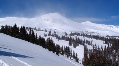
Butler Gulch is a forested and alpine valley south of Jones Pass and the Henderson mine. Trailhead is at 10,440 feet along the Jones Pass Road; timberline is about 11,400 feet. The head of the gulch is flanked by extensive talus and rock-glacier deposits and contains a few abandoned mines and glacial moraines.
- Suitable Activities: Hiking, Snowshoeing, Backcountry Skiing/Splitboarding, Ski Mountaineering
- Snowshoeing Category: Intermediate
- Seasons: Year-round
- Weather: View weather forecast
- View avalanche forecast.
- Length: 6.5 mi
-
Land Manager:
U.S. Forest Service
Clear Creek Ranger District (ARNF)
- Parking Permit Required: USFS Permits & Passes
- Recommended Party Size: 12
- Maximum Party Size: 12
- Maximum Route/Place Capacity: 12
This is a list of titles that represent the variations of trips you can take at this route/place. This includes side trips, extensions and peak combinations. Not seeing a title that fits your trip? Log in and send us updates, images, or resources.
- Butler Gulch: Backcountry Skiing and Ski Mountaineering
There are no resources for this route/place. Log in and send us updates, images, or resources.
