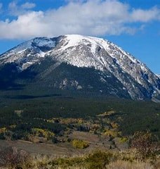
Buffalo Peak
Jefferson County Highpoint. This hike is 100% off trail. You will be rewarded with your hard work with gaining the highest summit in Jefferson County
For further information and any restrictions see: Buffalo Peak & "The Wigwam" : Climbing, Hiking & Mountaineering : SummitPost
Directions to trailhead: Stoney Pass Rd - Google Maps
To review the Trip Leader Checklist see: Shared R:P+Trip Leader Activity Checklists - Google Docs
- Suitable Activities: Hiking
- Seasons: Year-round
- Weather: View weather forecast
- Avalanche Terrain Rating Simple
- Difficulty: Difficult C
- Length: 6.0 mi
- Elevation Gain: 3,000 ft
- 11,599 ft
-
Land Manager:
U.S. Forest Service
Lost Creek Wilderness Area
- Parking Permit Required: USFS Permits & Passes
- Recommended Party Size: 6
- Maximum Party Size: 15
- Maximum Route/Place Capacity: 15
There are no resources for this route/place. Log in and send us updates, images, or resources.
