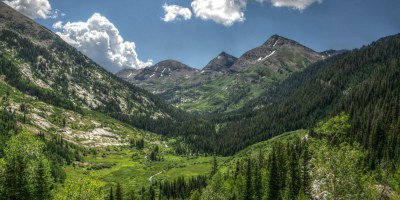
BPX Trip - 4-Day: Raggeds Wilderness Dark Canyon Figure 8 Loop
This 29.8 mile / 8,441 ft. elevation gain loop in the Raggeds Wilderness Area. Raggeds Wilderness covers 65,443 acres spanning Gunnison and White River National Forests. Elevations range from 7,000 to about 13,000 feet. Prominent rocky slopes point upward to a serrated ridge which gives Raggeds Wilderness its name.
Suggested Backpacking Section (BPX) itinerary for 4-day trip to be used for CMC trips led by BPX leaders for BPX members:
Day 1: Hike north from Horse Ranch Park (trailhead) to Anthricite Creek via Dyke Mountain Bike Trail #838, Dyke Creek Trail #837, and Silver Basin Trail #834. Camp near the Anthricite Creek at the junction of Dark Canyon Trail and Munsey-Ruby Stock Driveway Trail (9.8 miles, +2,117 / -3,800 ft).
NOTE: There is significant elevation loss on this day.
Day 2: Depart camp and take the Munsey-Ruby Stock Driveway Trail #831 and immediately ascend up to a point called Lightning Ridge. On this day we will hike up to higher elevations and make a loop around Dark Canyon. We will also leave the Raggeds Wilderness boundary for a few miles and pass through Erickson Springs Campground, and eventually drop back down into Dark Canyon. After the Erickson Springs Campground we will get back on the Dark Canyon Trail #830 and aim to camp along Anthracite Creek once we re-enter the Raggeds Wilderness boundary (7.4 miles, +2,700 / -3,100 ft.).
NOTE: Most of the day's elevation gain is in the first 3 miles.
Day 3: Hike Dark Canyon Trail all the way to Silver Creek. Camp at Silver Creek (6.2 miles, +2,100 / - 734 ft.)
Day 4: Leave camp at Silver Creek and hike the rest of the Dark Canyon Trail to the trailhead at Horse Ranch Park (6.4 miles, +1,612 / -1,023 ft.).
- Suitable Activities: Backpacking
- Seasons: June, July, August, September, October
- Weather: View weather forecast
- Difficulty: Challenging
- Length: 29.8 mi
- Elevation Gain: 8,441 ft
- 10,268 ft
-
Land Manager:
U.S. Forest Service
Raggeds Wilderness Area, Gunnison Ranger District (GMUG)
- Parking Permit Required: USFS Permits & Passes
- Recommended Party Size: 8
- Maximum Party Size: 15
- Maximum Route/Place Capacity: 15
- Trails Illustrated 128
- Raggeds Wilderness - Outdoor Trail Maps
There are no resources for this route/place. Log in and send us updates, images, or resources.
