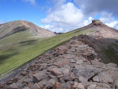
BPX Trip - 4-Day: Loop from South Lottis TH to Summerville TH
This 30.0 mile / 8,004 ft. elevation gain loop in the Fossil Ridge Wilderness Area goes through pine forests and aspen groves, and meadows. Wildlife is abundant here.
Suggested Backpacking Section (BPX) itinerary for 4-day trip to be used for CMC trips led by BPX leaders for BPX members:
Day 1: Drive to South Lottis Trailhead (approx. 3 1/2 hrs. from Golden). Starting at the South Lottis Trailhead hike 4.2 miles on the South Lotus Trail #428 to the intersection with the Henry Lake Trail. Turn right on the Henry Lake Trail and take it for 1.9 miles to Henry Lake (6.1 miles, +2,605 ft.).
Day 2: Hike from Henry Lake to Lamphier Lake via the Henry Lake & South Lotus Trails. Camp at Lamphier Lake (5.6 miles, +1,587 /-1,564 ft.)
NOTE: we will pack up and leave camp early on Day 2 because we have to cross Gunsight Pass on this day. The pass is right before we get to our campsite at Lamphier Lake and we want to be off the pass before afternoon thunderstorms arrive.
Day 3: Hike south on the South Lotus Trail #428 for 2.6 miles to the Gold Creek Trailhead. From the Gold Creek Trailhead hike west for 5.5 miles on the Fossil Ridge Trail #478 to the intersection with the Summerville Trail #430. Hike north on the Summerville Trail #430 for 1.6 miles to Crystal Creek which is at the junction of the Summerville Trail #430 and the Van Tyul Trail #431 (9.6 miles, +2,446 / -3,453 ft.)
Day 4: Hike to the Summerville TH via the Summerville Trail #430 (8.9 miles +1,400 / -3,300 ft.)
Overall Route: 30 miles, +7,900 / -8,256 ft.
NOTE: Shuttle time from South Lottis Trailhead to Gold Creek Trailhead is 5 minutes.
- Suitable Activities: Backpacking
- Seasons: June, July, August, September
- Weather: View weather forecast
- Difficulty: Challenging
- Length: 30.0 mi
- Elevation Gain: 8,004 ft
- 12,200 ft
-
Land Manager:
U.S. Forest Service
Fossil Ridge Wilderness Area, Gunnison Ranger District (GMUG)
- Parking Permit Required: USFS Permits & Passes
- Recommended Party Size: 8
- Maximum Party Size: 15
- Maximum Route/Place Capacity: 15
- Trails Illustrated 131
- Trails Illustrated 132
There are no resources for this route/place. Log in and send us updates, images, or resources.
