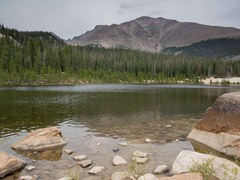
Sandbeach Lake (10,283’) is located 4.25 miles / 2,060 ft. from the Wild Basin Entrance Station in Rocky Mountain National Park. It’s one of the Park’s deepest lakes at nearly 50', and aptly named for its wide, sandy shore.

Sandbeach Lake (10,283’) is located 4.25 miles / 2,060 ft. from the Wild Basin Entrance Station in Rocky Mountain National Park. It’s one of the Park’s deepest lakes at nearly 50', and aptly named for its wide, sandy shore.
Far away from any paved roads, this moderate hike provides beautiful scenery and desolate lake hang outs. This less than 4-mile out-and-back trail gains 1,200 ft in elevation, and is wide open at the top for further exploration.
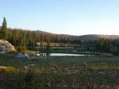
This is an out and back, moderately difficult, trail to seven alpine lakes in the Mount Zirkel Wilderness area. The trip starts at the Seven Lakes TH at west end of Big Creek Lakes Campground. The trail is 12.6 miles and has 2,300 feet elevation gain RT and optional hiking to 11,800 feet high point on divide of 6.0 miles and 2,000 elevation gain RT.
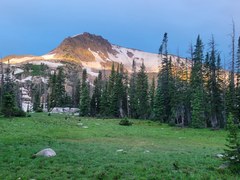
This is an out and back, difficult trip, in the Mount Zirkel Wilderness area with two nights at a beautiful subalpine lake and a day hike to either top of Mount Ethel or Lost Ranger Peak, both on the Continental Divide, or an alpine lake named Roxy Ann. Total backpacking distance is 12.8 miles with 2,600 feet elevation gain.
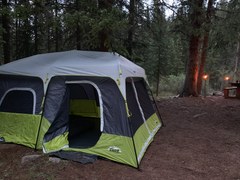
The Ranger Lakes and Crags Campground are located in State Forest State Park, east of Walden, near Ranger Lakes, Nokhu Crags and Cameron Pass. Crags Campground is set in dense forest, the campground is tent-oriented because, while accessible by sedans, the access road is too steep, narrow, and winding for trailers and most RVs. Ranger Lakes is easier to get to and open after Labor Day. Both are great!
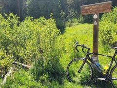
This 2.2 mile trail accesses the beautiful Timberline Lake in the Holy Cross Wilderness. Timberline Lake Trailhead is located at the western end of Turquoise Lake, just northwest of the May Queen Campground. The trail enters the Holy Cross Wilderness soon after intersecting with the Colorado Trail. Wilderness regulations apply, as well as special fishing regulations. The native Greenback Cutthroat Trout has been reintroduced into this lake and Lake Fork Creek. Fishing is catch and release only.
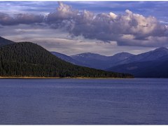
Enjoy a 3-day group campout at Printer Boy Campground on the eastern shore of Turquoise Lake. With easy access to boat ramps and hiking trails, as well as being within driving distance of the Mt Massive and Holy Cross Wilderness areas, there are lots of options for excursions from this campground.
Three day trip into Holy Cross Wilderness to Lower and Upper Turquoise Lakes with opportunity to hike to two additional lakes on Day 2 or fish. Lower lake is 12.2 miles and 2,900 feet elevation gain and upper lake is slightly farther and higher.
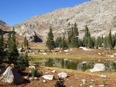
Explore the remote western side of Indian Peaks Wilderness on this difficult 16-mile out-and-back that visits two lakes that see fewer visitors than nearby Mirror and Crater Lakes, but rival their beauty. This trip takes you through Hell Canyon and ends at a high alpine lake below Cooper Peak and Marten Peak, which can be summited by savvy scramblers.
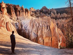
This 14.2 mile and 3,200 vertical feet, out and back moderately difficult trip, located near the old mining town of Creede, takes you to the Wheeler Geologic Area known for its geological formations formed from eroded volcanic ash. The area is unique and fascinating.
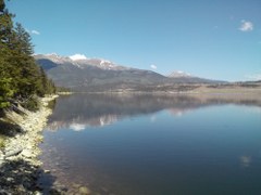
At 9,300 ft. Whitestar Campground at Twin Lakes Reservoir has amazing mountain views of the Collegiate Peaks Range.
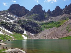
Hike into the Eagles Nest Wilderness for wildflowers, fishing, and great alpine lake scenery, just below the high edge of the Gore Range. This difficult 18 miles and 2,900 vertical feet out-and-back gets takes you to a beautiful cirque with several lakes.
This 1 mile and only 850 vertical feet trail accesses the beautiful Windsor Lake in the Mount Massive Wilderness. Optional hike around the lake on day 2. Abundant wildflowers in the season
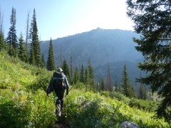
Hike 10 miles around the stunning Zirkel high peaks, camping at a different lake each night. This moderately difficult trip is 10.4 miles long with 2,400 feet of elevation gain or cover same in four day to make this an easy trip.
Hike to a beautiful lake in the Maroon Bells/Snowmass wilderness located beneath majestic Capitol Peak with waterfalls, great fishing, great wildflowers and possibly a scenic day hike around the peak to Capitol Lake. This is a 4-day Out and Back, total 20 miles and 4,400 ft elevation gain.
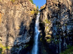
Experience the remote South San Juans Wilderness with this 19-mile moderate backpacking loop, featuring 2500 feet of gain and opportunities for multiple side trips, such as Glacier Lake and Lake Ann. The loop follows the CDT, including sections above treeline, and passes several lakes and the incredible Conejos Falls.
Hike up to Crag Crest Trail on Grand Mesa then down to the Bull Creek Reservoirs for a couple of days with optional hiking and fishing. This is a chill trip with dramatic views all around. Totals for this 4-day out and back trip are 9 miles and 1,670 ft elevation gain.
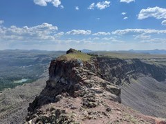
Undertake this classic Flattops Wilderness hike to the beautiful, five mile long Chinese Wall and the daunting Devils Causeway. Enjoy beautiful lakes and 360-degree panoramas for a unique Colorado experience. This 26 mile long loop trip is difficult with over 5,000 vertical feet in four days.
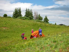
This challening and beautiful, 26 mile loop trail takes you around the iconic Maroon Bells mountains in the Maroon Bells-Snowmass Wilderness. The route climbs over four mountain passes each well over 12,000 feet for a total elevation gain of 8,200ft - do not under estimate this strenous trip.
Discover the San Juan Mountains in this stunning 16 mile loop with 4,200 feet of vertical in the Uncompahgre Wilderness Linking the Larson and Crystal Lake Trails, this exploration of Colorado’s high country offers countless wildlife opportunities as it passes through dense aspens, pine forests, meadows and boulder fields. Crystal Peak (12,933’) is in view for most of this adventure.