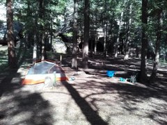
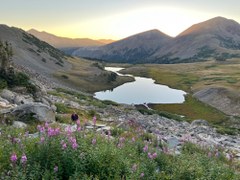
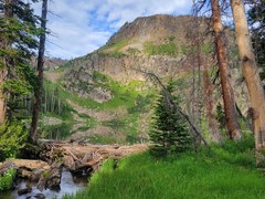
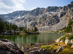
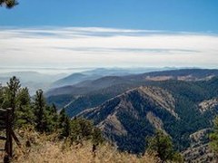
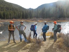
This is an out and back, easy early season and close-in trip. Colorado Trail Segment 3 - Little Scraggy TH to Morrison Creek. Intended for use as pre-season gear shakedown trip for those wanting to test their personal fitness and backpacking equipment, before hitting the long trails. Could also be an easy after work hike in with a short trek to camping overnight, hike out the following day. Total distance 6.0 miles and 900 feet elevation gain.
This is a moderate out and back hike in the State Forest State Park to the American Lakes area near Cameron Pass. Roundtrip to the lakes (11,300 ft.) is approximately 7.4 miles and 1,500 ft elevation gain.
This is an out and back, moderately difficult trip in the Mount Zirkel Wilderness area to a beautiful subalpine lake just below the Continental Divide. The trail starts at the Katherine TH and is 5.0 miles and 1,200 elevation gain RT.
Short overnight trip with an out and back hike up to Brady Lake near Homestake Reservoir in the Holy Cross Wilderness. Enjoy great scenery, fishing, and explore the surrounding area. Total 2.6 miles and 700 ft elevation gain.
This difficult 11.2 mile out-and-back takes you to Cherry Lake high in the Sangre di Cristo Wilderness just north of Crestone, with an option to make camp below or above tree line. You can add a day to the trip and summit a number of nearby 13'ers.
This difficult 14.4 mile trip is a beloved Colorado classic, ending at the photogenic Mirror Lake with Lone Eagle Peak's distinctive profile reflected in the still alpine waters. As one of the most popular destinations in Indian Peaks Wilderness, make sure you have the correct permits and camp only at designated sites around Mirror and Crater Lakes.
An easy out and back trip in the Indian Peaks Wilderness from Fourth of July TH to scenic waterfall and beautiful alpine lake. Total distance is 5.2 miles with 1,300 feet elevation gain.
Early season and close in trip to Golden Gate Canyon State Park with camping at Frazer Meadows. Could be after work backpacking trip with varied hike out the following day. Easy trip with only 5.2 miles out and back 1,300 feet elevation gain.
Moderate trail along French Creek, on and off trail, out and back for as far as you like. Option to continue up to French Pass. Round trip to the pass (12,640ft) is 9 miles and 1,900ft elevation gain.
Trip to beautiful Lake Constantine with good fishing a waterfall and upper lakes to explore in the Holy Cross Wilderness Area. This out-and-back trip is only 8 miles and 1,500 vertical feet of elevation gain total.
An easy 2-day out-and-back route to Lake Katherine, a sub-alpine lake in a large cirque just below the Continental Divide in the Mount Zirkel Wilderness area.
Enjoy 2 days in the Sangre de Cristos with this partial loop hike to Lake of the Clouds. The first day requires almost 2500 of climbing, making this a difficult trip. At the top, find a series of small lakes and views of surrounding peaks. Total loop is
Hike to a beautiful lake in Fossil Ridge wilderness with good fishing surrounded by several high peaks. Includes an option to climb to nearby Gunsight Pass and possibly beyond. This moderate out-and-back trip is only 5 miles and 1,700 vertical feet of elevation.
This is a moderately difficult loop trip in the Snowy Range in southeast Wyoming and makes a loop around Browns Peak going through the glacier gap with an overnight at Crescent Lake. Total distance 11.4 miles and 1,600 feet elevation gain.
This difficult 12-14 mile out-and-back takes you to the Macey Lakes Basin between Colony Baldy and Little Baldy Peaks in the Sangre de Cristos Wilderness, with an option to summit Colony Baldy (13,705 ft) from the basin, a class 2 scramble.
A moderate two day, one night backpack to camping by Native Lake. 7.6 miles and 1,100 vertical feet total.
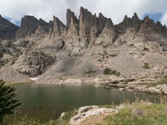
Sky Pond is located 3.8 miles / 1,360 ft. from Bear Lake Trailhead in Rocky Mountain National Park. The lake sits above Lake of Glass in a deep valley capped by Taylor Glacier, Taylor Peak (13,153'), Powell Peak (13,208') and The Sharkstooth (12,630').
Hike to a beautiful lake in a scenic basin below high peaks, including Eagles Nest Peak, in the Eagles Nest Wilderness. Lollipop route is 12.2 miles and 2,830 vertical feet.
Easy loop hike in White Ranch Open Space close to Golden. Expansive views of ranch lands and varied wildlife habitats. Total distance is 5.5miles and 1,000ft elevation gain. High point is 7,500ft.
A moderate 8-mile out-and-back trip from the east end of Wigwam Trail in the Lost Creek Wilderness makes for a good shoulder-season trip, and offers fishing at a series of beaver ponds.
