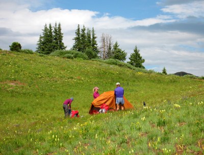
BPX 4-Day: Four Pass Loop from West Maroon Trailhead
This challening and beautiful, 26 mile loop trail takes you around the iconic Maroon Bells mountains in the Maroon Bells-Snowmass Wilderness. The route climbs over four mountain passes each well over 12,000 feet for a total elevation gain of 8,200ft - do not under estimate this strenous trip.
You will hike up and over four mountain passes - West Maroon, Frigid Air, Trail Rider and Buckskin. You will be surrounded by 13 and 14,000 foot peaks. Depending on time of year, the basins will likely be full of wildflowers. You have lakes, streams, forests, and of course high rocky passes. There are camping areas along the route. Water is available. Plan carefully so you are not up high on a pass during an afternoon thunderstorm and lightning storm. Bear canisters are required when camping overnight. There are numerous requirements for permits, shuttles and parking.
Suggested Backpacking Section (BPX) itinerary for 4-day trip to be used for CMC trips led by BPX leaders for BPX members.
Day 1: Arrive at the Maroon Lake Trailhead by 07:30, hike over West Maroon Pass, hike some more and camp in the East Fork Zone.
Day 2: Hike over Frigid Air Pass, hike some more and camp in the North Fork Zone.
Day 3: Hike over Trail Rider Pass, hike some more and camp in the Snowmass Lake Zone.
Day 4: Hike over Buckskin Pass, enjoy Crater Lake and hike out to Maroon Lake Trailhead.
Driving Directions: Take I-70 W to CO-82 E in Glenwood Springs. Take exit 116 from I-70 W. Continue on CO-82 E to Maroon Creek Road. Scenic Route: I-70 W to CO -195 S to Leadville. Take 24-S towards Buena Vista. Take 82-W to Aspen. Drive through Aspen and at the roundabout take Maroon Creek Rd.
General Requirements:
Overnight Camping Permits (2 registration cycles, mid-February and mid-June. Be organized and on-line at opening time to have a shot at securing your permits. They go super fast.)
https://www.recreation.gov/permits/4675333
Maroon Bells-Snowmass Wilderness Area 5 Camping Zones - overnight permits required for each stay in a zone. This trip configuration has overnight camping in the East Fork, North Fork, and Snowmass Lake Zones. This trip configuration has a maximum of (4) persons including the BPX Trip Leader.
https://www.fs.usda.gov/Internet/FSE_DOCUMENTS/fseprd1083862.pdf
Approved Bear Canisters List
https://grizzlybear.wpengine.com/wp-content/uploads/2021/09/210723_Certified_Products_List.pdf
https://trails.colorado.gov/routes/38017?t=inm0zhGg1t3FfHqX2eH8
- Suitable Activities: Backpacking
- Seasons: June, July, August, September, October
- Weather: View weather forecast
- Difficulty: Difficult
- Length: 26.0 mi
- Elevation Gain: 8,200 ft
- 12,500 ft
-
Land Manager:
U.S. Forest Service
Maroon Bells-Snowmass Wilderness Area, Aspen Ranger District (WRNF)
- Parking Permit Required: Maroon Bells Scenic Area
- Recommended Party Size: 4
- Maximum Party Size: 4
- Maximum Route/Place Capacity: 4
- Trails Illustrated 128
- COTREX
This is a list of titles that represent the variations of trips you can take at this route/place. This includes side trips, extensions and peak combinations. Not seeing a title that fits your trip? Log in and send us updates, images, or resources.
- Route may be hiked in either direction
There are no resources for this route/place. Log in and send us updates, images, or resources.
