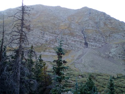
BPX 2-Day: Macey Lakes from Horn Creek TH
This difficult 12-14 mile out-and-back takes you to the Macey Lakes Basin between Colony Baldy and Little Baldy Peaks in the Sangre de Cristos Wilderness, with an option to summit Colony Baldy (13,705 ft) from the basin, a class 2 scramble.
Find great camping, waterfalls, and a collection of lakes in the Macey Lakes Basin in the Sangre di Cristo Wilderness. This area hosts some of the state’s famed 14ers, including Humboldt, Crestone, and Kit Carson Peaks. On this route, hikers have the option to add a 3rd day to the itinerary and climb Colony Baldy (13,705 ft.), the state’s 143rd highest peak and a less-busy peak than its nearby neighbors. The 3 day option with the peak makes for a 15 mile route with 4,800 ft. gain, with route-finding and off-trail portions. Either option makes for a difficult backpacking trip due to the elevation gain.
Suggested Backpacking Section (BPX) itinerary for 2-day trip to be used for CMC trips led by BPX leaders for BPX members:
Day 1: Starting at the Horn Creek TH, hike 0.6 miles on the Horn Creek Trail (#1342) to the intersection with the Rainbow Trail (#1336). Go left/south on Rainbow Trail (#1336) for 2.5 miles to junction with Macey Trail (#1341). Make right on Macey Trail (#1341) and ascend for 3.1 miles to Lower Macey Lake and make camp in this area (6.2 miles, +2,551 / -82 ft).
Day 2: Explore the upper Macey Lakes and break camp and hike out to the Horn Creek TH (6.2 miles, +82 / -2,551 ft.).
Optional Day Hike: upper Macey Lakes, 1.9 miles, +-530 ft.
Overall Route: 12.4 miles, +-2,632 ft.
NOTES:
- Always practice Leave No Trace techniques.
- More information about Sangre de Cristo Wilderness is available here.
- Alternate: 3-day option with Colony Baldy: Contour around north end of lower Macey Lake and then along west shore to trail junction, make left at this junction and continue south to South Macey Lake at 11,643 feet. Continue along South Macey's east shore, with a short bushwhack through willows while ascending southeast out of the cirque, then up easy grassy tundra to intersect Colony Baldy's southwest ridge near 13,000 ft. Continue up this ridge to summit (class 2). Reverse route back to camp for night (2.5 miles, 2200 feet gain). Break camp and hike out the next day (6.1 miles, 2591 feet loss).
- Driving Directions: Take I-25 South to Colorado Springs, take exit 140 for Tejon Street. Turn right onto CO-115 S/S Nevada Ave. Take CO 115 South for 32 miles. Turn left on CO 67 South. Turn right on CO 96 West. Continue on Main Street. Turn left onto CO-69 S/S 6th St. Follow Schoolfield Rd, Macey Ln and Horn Rd to your destination.
- Google Map Driving Directions: From the Colorado Mountain Club (Golden, CO) to the Horn Creek TH.
- Suitable Activities: Backpacking
- Seasons: July, August, September
- Weather: View weather forecast
- Difficulty: Difficult
- Length: 12.4 mi
- Elevation Gain: 2,632 ft
- 11,565 ft
-
Land Manager:
U.S. Forest Service
Sangre de Cristo Wilderness Area, San Carlos Ranger District (PSINF)
- Parking Permit Required: USFS Permits & Passes
- Recommended Party Size: 6
- Maximum Party Size: 12
- Maximum Route/Place Capacity: 12
This is a list of titles that represent the variations of trips you can take at this route/place. This includes side trips, extensions and peak combinations. Not seeing a title that fits your trip? Log in and send us updates, images, or resources.
- 3-Day: Macey Lakes and Colony Baldy from Horn Creek TH
There are no resources for this route/place. Log in and send us updates, images, or resources.
