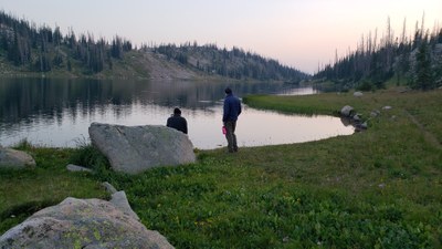
BPX 6-Day: Tour of Mount Zirkel Wilderness lakes from Katherine TH
Hike into the Mount Zirkel Wilderness and fish and enjoy some of the most beautiful lakes in Colorado. Hike on the scenic and wide-open Continental Divide Trail with camping at a different lake each night. This out-and-back wandering trip is 42 miles and 9,000 vertical feet spread out over 6 days.
Suggested Backpacking Section (BPX) itinerary for 6-day trip to be used for CMC trips led by BPX leaders for BPX members.
Day 1. Hike the Lone Pine Trail (#1129) to the Continental Divide. From the divide, turn south to the Three Island Lake Trail (1163.1A). Then hike northwest toward Island Lake and make camp near the lake (8 miles/2,200').
Day 2. Hike back to the Continental Divide and follow the CDT south to the Lake of the Crags Trail (#1182). Hike southwest towards Luna Lake and make camp. (11 miles/2,600').
Days 3. Hike west on the lake of the Clouds Trail to a cluster of lakes (Mirror Lake, Lake Margaret, Fish Hook Lakes and Lake Edward) and camp. There is an option to stay there for two nights. (4.0 miles/225').
Day 4. Hike back east to Luna Lake and south to Lake Elbert and make camp (5 miles/1,200').
Day 5. Hike back to the Continental Divide and turn north on the CDT and hike to the North Lake Trail (#1164). Then head west down to the North Lake area and make camp for the night (10 miles/1,700').
Day 6. Hike back to the Continental Divide and hike north to the Lone Pine Trail and return to the trailhead (8 miles/850').
Alternate 7-Day: Add additional day for fishing at Mirror Lake, Lake Margaret, Fish Hook Lakes.
Driving Directions: From Walden. Drive west on Hwy 14 approximately 1/4 mile and take County Road 12W west. Drive approximately 5 miles and take County Road 7 north for approximately 2 1/2 miles. Turn left on County Road 12W. After approximately 4 miles take the left fork heading west on Co Rd 16. Drive approximately 6 miles. The road will turn into Forest Road 640. Pass the Lone Pine South and North trailheads and continue to end of road and Katherine Trailhead with ample parking.
- Suitable Activities: Backpacking
- Seasons: July, August, September
- Weather: View weather forecast
- Difficulty: Difficult
- Length: 42.0 mi
- Elevation Gain: 9,000 ft
- 11,901 ft
-
Land Manager:
U.S. Forest Service
Mount Zirkel Wilderness Area, Parks Ranger District (RNF)
- Parking Permit Required: USFS Permits & Passes
- Recommended Party Size: 6
- Maximum Party Size: 12
- Maximum Route/Place Capacity: 12
- Trails Illustrated 117
- Trail Illustrated 116
This is a list of titles that represent the variations of trips you can take at this route/place. This includes side trips, extensions and peak combinations. Not seeing a title that fits your trip? Log in and send us updates, images, or resources.
- BPX 7-Day: Tour of Mount Zirkel Wilderness lakes from Katherine TH
There are no resources for this route/place. Log in and send us updates, images, or resources.
