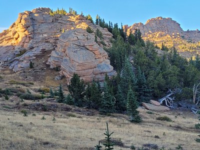
BPX 3-Day: Bison and McCurdy Peaks from Lost Park TH
This out and back is in the Lost Creek Wilderness area near Bison and McCurdy Mountains ascending from the Lost Park Trail Head. Total distance out and back about 26 miles which includes side trips (totaling 5 miles) up Bison Peak and McCurdy Mountain. Total Elevation gain 2900 ft. with the side trips up the mountains and to Hay Creek as day hikes.
Suggested Backpacking Section (BPX) itinerary for 3-day trip to be used for CMC trips led by BPX leaders for BPX members:
Day 1: Starting at the Lost Park TH hike south along the Brookside-McCurdy Trail (#607) to the trail intersection with Ute Creek Trail (#629). Turn left onto the Ute Creek Trail (#629) and hike for about a mile and setup camp (5.9 miles, +1,973 ft.) NOTE: There isn't any water in this area so it is recommended you fill up on water from Indian Creek about 2 miles before camp.
Day 2: Start the day by doing an out-n-back day hike to Bison Peak (12,341 ft.) (1.4 mile RT, 536 ft. elevation gain/loss). Return to camp, pack up and hike south-east along the Ute Creek Trail (#629) for about 2.0 miles with an elevation loss of 480 ft. to new camp site near McCurdy Mountain. Set up camp (11,200 ft). Day pack to Hay Creek (elevation 10,750 ft) for water for 2 days (4-6 liters/person) (4.5 miles RT, elevation loss/gain 1,130 ft.). Hike up McCurdy Mt. and nearby no name peak (12,157ft) (2.2 miles RT, 1,100 ft. elevation gain/loss). Rest up, read and/or and scout around rest of day.
Day Hike: Bison Peak (1.4 miles, +-536 ft.)
Route: Water at Hay Creek (4.5 miles, +-1,130 ft.)
Day Hike: McCurdy Mountain (2.2 miles, +-1,100 ft.)
Day 3: Pack up and return to cars via the Brookside-McCurdy Trail (#607) (8.1 miles, +745 / -2,278 ft.). Water is on the way on the Brookside-McCurdy Trail (#607).
Overall Route: 16.2 miles, +-2,949 ft.
NOTES:
- Always practice Leave No Trace techniques.
- More information about Lost Creek Wilderness is available here.
- Driving Directions: From the Colorado Mountain Club (Golden, CO) to the Lost Park TH.
- Suitable Activities: Backpacking
- Seasons: June, July, August, September, October, November
- Weather: View weather forecast
- Difficulty: Difficult
- Length: 16.2 mi
- Elevation Gain: 2,949 ft
- 11,883 ft
-
Land Manager:
U.S. Forest Service
Lost Creek Wilderness Area, Pikes Peak Ranger District (PSINF)
- Parking Permit Required: USFS Permits & Passes
- Recommended Party Size: 6
- Maximum Party Size: 8
- Maximum Route/Place Capacity: 8
- Trails Illustrated 105
This is a list of titles that represent the variations of trips you can take at this route/place. This includes side trips, extensions and peak combinations. Not seeing a title that fits your trip? Log in and send us updates, images, or resources.
- Bison Peak
There are no resources for this route/place. Log in and send us updates, images, or resources.
