BPX 3-Day: Zirkel Circle from Slavonia TH
Hike 10 miles around the stunning Zirkel high peaks, camping at a different lake each night. This moderately difficult trip is 10.4 miles long with 2,400 feet of elevation gain or cover same in four day to make this an easy trip.
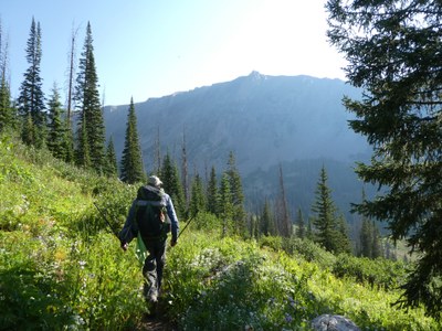
Revel in flower filled meadows, crystalline lakes, and stunning views of the Continental Divide on a 10.4 mile journey that follows the rushing waters of Gold Creek to reach the pine lined shores of Gold Creek Lake. Worth every ounce of effort, the steep climb up to Gilpin Lake delivers panoramic views of jagged peaks. The Gilpin Trail then drops steeply down and parallels Gilpin Creek back to the TH.
Suggested Backpacking Section (BPX) itinerary for 3-day trip to be used for CMC trips led by BPX leaders for BPX members.
Day 1: Drive to Slavonia TH (approx. 3.5 hrs from Golden). Pit toilets. Start hike on the Gilpin Lake Trail (#1161) and after about ¼ mile you will reach a fork. Turn right on the Gold Creek Lake Trail (#1150). You will be hiking counter clockwise as the views are much better in this direction. This part of the trail is heavily shaded with some waterfalls. Hike about (3 miles, +1,241 / -114 ft.) to Gold Creek Lake and find camping. Note that camping must be at least 1/4mile from the lake.
Day 2: Continue hiking the steady ascent up to Gold Creek Lake Trail (#1150). After about 1.5 miles you will come to a fork with the Gilpin Lake Trail (#1161). Turn left on this trail and continue another 1.5 miles to reach gorgeous Gilpin Lake (3.1 miles, +1,271 / -487 ft). Find camping at least ¼ mile from the lake.
Day 3: Complete the Zirkel Circle by continuing on the Gilpin Lake Trail (#1161) back to the Slavonia TH. This final 4.5 miles is virtually all downhill along Gilpin Creek. (4.3 miles, +75 / -2,031 ft.).
Overall Route: 10.4 miles, +-2,534 ft.
NOTES:
- Always practice Leave No Trace techniques.
- More information about Mount Zirkle Wilderness is available here.
- The Slavonia TH is very popular so plan accordingly to secure parking. If you want to arrive the night prior, dispersed camping is available on the road to the TH.
- Camping must be at least ¼ mile away from Gold and Gilpin Lakes.
- Alternate: BPX 4-Day: Zirkel Circle from Slavonia TH - follow same loop but in clockwise direction with first night only 2.1 miles up the Gilpin trail to split the majority of the ascent into two days.
- Driving Directions: From the Colorado Mountain Club (Golden, CO) to the Slavonia TH.
- Suitable Activities: Backpacking
- Seasons: July, August, September
- Weather: View weather forecast
- Difficulty: Moderate
- Length: 10.4 mi
- Elevation Gain: 2,534 ft
- 10,771 ft
-
Land Manager:
U.S. Forest Service
Mount Zirkel Wilderness Area, Hahns Peak/Bears Ears Ranger District (RNF)
- Parking Permit Required: USFS Permits & Passes
- Recommended Party Size: 6
- Maximum Party Size: 15
- Maximum Route/Place Capacity: 15
- Trails Illustrated 117
This is a list of titles that represent the variations of trips you can take at this route/place. This includes side trips, extensions and peak combinations. Not seeing a title that fits your trip? Log in and send us updates, images, or resources.
- 4-Day: Zirkel Circle from Slavonia TH
There are no resources for this route/place. Log in and send us updates, images, or resources.
