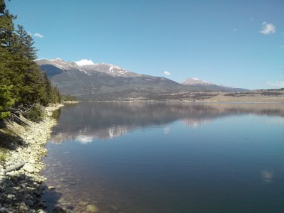
BPX 3-Day: Twin Lakes Reservoir / Whitestar Campground
At 9,300 ft. Whitestar Campground at Twin Lakes Reservoir has amazing mountain views of the Collegiate Peaks Range.
Whitestar Campground is 22 miles southwest of Leadville, composed of three loops and is near the Twin Lakes Reservoir. Sixty-six total campsites within Sage Loop, closest to the lake, Ridge Loop with views of the lake and mountains, and Valley Loop with sites farthest from the lake.
Reservations are not required but the campground is very popular; the most popular reservable sites are 8, 10, 13, 15 and 17 which are closest to the lake. Ridge Loop sites 37, 38, 39 have the best views.
Suggested Backpacking Section (BPX) itinerary for 3-day trip to be used for CMC trips led by BPX leaders for BPX members.
Day 1: Prior to driving to camp, do an out & back hike along Forest Service Road 137 to Buckeye Lake (4.25 mi, +-1,668 ft.). The route starts along trail to Sangree's Hut, trail has steady climb. At the lake enjoy the views of Buckeye Peak, return to TH and travel to campground, make camp for 2 nights
Day 2: Fish, leisure in camp, or hike Colorado Trail segments. Suggested easy trail - Interlaken - 4.6 mile/200'gain, Out & Back around shoreline
Day 3: Break camp, return via Hwy 285 to almost to Fairplay and do a loop hike on the Tie Hack Trail (659) (5.25 miles, +-875 ft.). The trail is a lollipop configuration and can be hiked in either direction. Return home.
NOTES:
-
Amenities: Picnic table, lantern poles, fire grates, firewood for sale, potable water pump, vault toilets; many but not all sites have tent pads.
-
Lake Activities: All water sports and water craft are permitted; Twin Lakes reported to have trout for anglers.
-
More information about Whitestar Campground is available here.
- Driving: From Golden - 112 miles/2 hrs. From Golden - I-70 W to Exit 195 to Leadville, from Leadville take US 24 for 15 miles, turn right (west) on Hwy 82 and proceed about 7 miles
- Nearest 24/7 ER: Saint Vincent Health 822 W 4th St, Leadville 719 486 0230
- Lake County Sheriff: County Court House, 505 Harrison Ave, Leadville
- Suitable Activities: Camping
- Seasons: May, June, July, August, September, October
- Weather: View weather forecast
- Difficulty: varies
- Length: 15.0 mi
- Elevation Gain: 2,700 ft
- 9,300 ft
-
Land Manager:
Land Manager Varies
Mount Massive Wilderness Area, Leadville Ranger District (PSINF)
- Parking Permit Required: Other
- Recommended Party Size: 6
- Maximum Party Size: 12
- Maximum Route/Place Capacity: 12
- Trails Illustrated 110
There are no resources for this route/place. Log in and send us updates, images, or resources.
