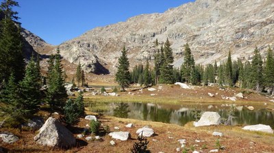
BPX 3-Day: Watanga and Upper Stone Lakes from Roaring Fork TH
Explore the remote western side of Indian Peaks Wilderness on this difficult 16-mile out-and-back that visits two lakes that see fewer visitors than nearby Mirror and Crater Lakes, but rival their beauty. This trip takes you through Hell Canyon and ends at a high alpine lake below Cooper Peak and Marten Peak, which can be summited by savvy scramblers.
Please view this document with everything you need to know about Indian Peaks Wilderness
Note: Overnight stays in Indian Peaks Wilderness in high season require advance permits.
Trip starts near Arapaho Bay on Lake Granby at the Roaring Fork TH. First night is in the forested area at Watanga Lake. Second night is at Upper Stone Lake (10,800 feet) at the upper end of Hell Canyon near the boundary between Indian Peaks Wilderness and RMNP. Parking is limited at Roaring Fork TH, and cars needs multi-day passes for the Recreation Area, obtained at the forest service office in Granby or at self-serve kiosks at the entrance to the recreation area.
Suggested Backpacking Section (BPX) itinerary for 3-day trip to be used for CMC trips led by BPX leaders for BPX members.
Day 1: Hike up the Roaring Fork Trail (Trl 3). Shortly after the TH, the trail climbs steeply about 1,000 ft on a south- facing slope. Then you are rewarded with a shady gently sloping hike in a healthy forest. Take left at the intersection with the Watanga Lake Trail. Lake Watanga itself is pretty but surrounded by forest; turn right when you get to the lake, hike up the marshy meadow to the SE and hike to the last little lake. (4.4 miles, 2,500 feet up and 0 down).
Day 2: Hike back down to the Roaring Fork Trail intersection and hike up from there to Upper Stone Lake. The climb gets steeper until you reach the ridge (a 1,400 ft climb from the intersection) separating the Roaring Fork Valley from Hell Canyon. You will cross exposed tundra with dramatic views of the Indian Peaks; there are also the ruins of a cabin. Then you hike down into Hell Canyon. There are a couple stretches of trail that are steep (32% grade) and on a very steep slope; this requires some focus as a stumble could have serious consequences; it’s quite doable as long as you don’t have fear of heights. (5.5 miles, 1,700 feet up and 1,700 down).
Day 3: Return down Roaring Fork to the TH and the vehicles (6.1 miles, 800 feet up and 3,300 down).
Driving Directions: Driving Directions: From I-70 west of Denver, take US Route 40 at Empire, go over Berthoud Pass to Winter Park; in Granby, turn right (N) onto US Route 34. Drive 5.3 miles on US 34, at the brown sign indicating Arapahoe Bay turn right onto CR 6 (Arapaho Bay Rd). Drive along Lake Granby until the end of the
lake, the road turns left and crosses Arapaho Creek; shortly after the bridge turn left towards the campground, continue to the Roaring Fork TH.
General Requirements: Hiking conditions are best from July through October. Go mid-week to avoid crowds.
- Suitable Activities: Backpacking
- Seasons: July, August, September
- Weather: View weather forecast
- Difficulty: Challenging
- Length: 16.0 mi
- Elevation Gain: 5,000 ft
- 11,251 ft
-
Land Manager:
U.S. Forest Service
Indian Peaks Wilderness Area, Sulphur Ranger District (ARNF)
- Parking Permit Required: Other
- Recommended Party Size: 7
- Maximum Party Size: 12
- Maximum Route/Place Capacity: 12
- Trails Illustrated 102
There are no resources for this route/place. Log in and send us updates, images, or resources.
