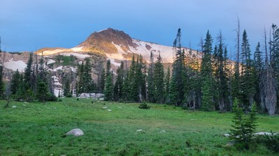
BPX 3-Day: Slide Lake and Continental Divide from Rainbow Lake TH
This is an out and back, difficult trip, in the Mount Zirkel Wilderness area with two nights at a beautiful subalpine lake and a day hike to either top of Mount Ethel or Lost Ranger Peak, both on the Continental Divide, or an alpine lake named Roxy Ann. Total backpacking distance is 12.8 miles with 2,600 feet elevation gain.
Suggested Backpacking Section (BPX) itinerary for 3-day trip to be used for CMC trips led by BPX leaders for BPX members.
Day 1: From the Rainbow Lake TH take the Rainbow Lakes Trail 1130 west. At the intersection with the Grizzly Helena Trail, jog right to stay on the Rainbow Lakes Trail. Good lunch stops along shore of Rainbow Lakes. Stay on this trail until you reach very faint trail to Slide Lake. Good camping is right on ridge from saddle before decent to lake. Set up camp for two nights. (6.4 miles, 2,300 feet up and 300 down).
Day 2: Day hike
Option 1: Hike up Mount Ethel; continue on 1130 northwest and continue off-trail to ridge west of trail starting from saddle just before Roxy Ann trail and once on ridge continue south to the clearly visible summit of Mount Ethel (3.7 miles, 1,500 up and 300 descent lake to peak).
Option 2: Hike up trail 1130 for 1.2 miles to take trail to Roxy Ann Lake on right and descend to lake (3.7 miles, 600 feet up and 1,200 down for Upper Slide to Roxy Ann).
Option 3: Hike to Lost Ranger Peak: continue on trail 1130 northwest past turn-off for Roxy Ann trail and once on ridge pick up CDT/Wyoming Trail 1101 north to the clearly visible summit of Lost Ranger Peak (4.1 miles, 1,700 up and 350 descent lake to peak) – see if you can identify artifacts on the summit.
Day 3: retrace your Day 1 steps to return to Rainbow Lake TH.
- Suitable Activities: Backpacking
- Seasons: July, August, September
- Weather: View weather forecast
- Difficulty: Challenging
- Length: 12.8 mi
- Elevation Gain: 2,600 ft
- 11,945 ft
-
Land Manager:
U.S. Forest Service
Mount Zirkel Wilderness Area, Parks Ranger District (RNF)
- Parking Permit Required: USFS Permits & Passes
- Recommended Party Size: 6
- Maximum Party Size: 15
- Maximum Route/Place Capacity: 15
- Trails Illustrated 117
There are no resources for this route/place. Log in and send us updates, images, or resources.
