BPX 3-Day: Rogers Pass Lake and Forest Lake loop from East Portal TH
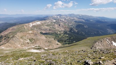
Hike to a beautiful lake in the James Peak Wilderness just below the Continental Divide with great views and explore exceptional terrain. Traverse CDT to Forest Lakes. This difficult loop is 18 miles and 4,300 vertical feet.
Suggested Backpacking Section (BPX) itinerary for 3-day trip to be used for CMC trips led by BPX leaders for BPX members.
Day 1. From the East Portal TH, hike on the South Boulder Creek Trail, #900 to Rogers Pass Lake and establish camp.(4 miles/1960’)
Day 2. Hike up to Rogers Pass, then take the CDT north to Corona Pass, camp at one of the Forest Lakes. (10.4 miles/2332’ up 2600 down) .
Day 2 alternate: It is possible to cut 4 miles of dirt road walking by bushwhacking from the CDT down to Forest Lakes. Conditions are unknown, needs to be evaluated.
Day 3. Return to trailhead (4 miles/200’) .
Driving Directions: From Nederland, travel south for 4.5 miles on Colorado Highway 119 to Rollinsville. Turn west onto the gravel Gilpin County Road 16 and continue eight miles to the Moffat Tunnel. A large parking area is available at the East Portal Trailhead.
General Requirements: Hiking above the lake is above treeline. Care is needed concerning weather.
- Suitable Activities: Backpacking
- Seasons: July, August, September
- Weather: View weather forecast
- Difficulty: Difficult
- Length: 18.0 mi
- Elevation Gain: 4,300 ft
- 12,233 ft
-
Land Manager:
U.S. Forest Service
James Peak Wilderness Area, Boulder Ranger District (ARNF)
- Parking Permit Required: USFS Permits & Passes
- Recommended Party Size: 6
- Maximum Party Size: 12
- Maximum Route/Place Capacity: 12
- Trail Illustrated 103
There are no resources for this route/place. Log in and send us updates, images, or resources.
