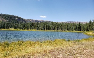
BPX 3-Day: Mosquito Lake from Stillwater TH with Day Hike over Devils Causeway
This easy 4.6 mile in and out backpack with only 600 feet vertical is combined with second day hike on wide open tundra along some of the Chinese Wall and then over the Devils Causeway, described in the Delorme Atlas & Gazetteer as a, “Unique natural feature, which is a quarter mile long rock bridge, only inches wide, with 1,000-foot shear drop-off on both sides”.
Suggested Backpacking Section (BPX) itinerary for x-day trip to be used for CMC trips led by BPX leaders for BPX members.
Day 1: Park at Stillwater TH and take Bear River Trail (#1120) west to Mosquito Lake. Good fishing in Bear Creek (2.3 miles, +500 / -140 ft.).
Day 2: Option to day hike to the Devils Causeway. Continue west on the Bear River Trail (#1120) where it climbs steeply up to above tree line and the Chinese Wall ridge. Last water for the day is in a small creek before the tree line. Once on the ridge, continue slightly downhill approximately 0.3 miles to the junction of north bound Chinese Wall Trail (#1803) – be careful not to take south bound Chinese Wall Trail (#1803) or descend further on Little Trapper Trail (#1814). Hike along ridge approximately 2.25 miles to the intersection with the Devils Causeway Trail (#1803.3). Turn right at the intersection and follow the Devils Causeway Trail (#1803.3) to the Devils Causeway (NOTE: Do not continue north on the Chinese Wall Trail (#1803)). The Devils Causeway is aptly named as the ridge narrows to just a few feet wide and the drop off on both sides is significant. Those not wanting to cross the Devils Causeway can return to camp the same way. For those that want to continue, carefully cross the causeway and continue a short distance on the ridge before making a steep descent and intersecting the East Fork Trail (#1119). Go right, or towards Stillwater Reservoir, on the East Fork Trail (#1119) and make a steep descent with switchbacks to Little Causeway Lake for a nice break. Continue down to the valley and retrace your steps from day 1 back up Bear River Trail (#1120) to camp (8.7 miles, +-1,756 ft.).
Optional Day Hike: Devils Causeway (8.7 miles, +-1,756 ft.)
Day 3: Return to Stillwater TH by reversing Day 1. (2.3 miles, +140 / -500 ft.).
Overall Route: 4.6 miles, +-650 ft.
NOTES:
- Always practice Leave No Trace techniques.
- More information about Flat Tops Wilderness is available here.
- More information about Stillwater Reservoir is available here.
- General Requirements: Hiking conditions are best from mid-June after major snow has melted through October. July can be buggy, but the flowers are best then.
- Driving Directions: From the Colorado Mountain Club (Golden, CO) to the Stillwater TH.
- Suitable Activities: Backpacking, Hiking
- Seasons: July, August, September
- Weather: View weather forecast
- Difficulty: Easy
- Length: 4.6 mi
- Elevation Gain: 650 ft
- 10,626 ft
-
Land Manager:
U.S. Forest Service
Flat Tops Wilderness Area, Yampa Ranger District (RNF)
- Parking Permit Required: USFS Permits & Passes
- Recommended Party Size: 6
- Maximum Party Size: 12
- Maximum Route/Place Capacity: 12
- Trail Illustrated 122
There are no resources for this route/place. Log in and send us updates, images, or resources.
