BPX 3-Day: Comanche Venable Figure-eight from Comanche Venable TH
This is a version of the classic Comanche Venables Loop to include the descent to west side of range in a figure-eight. This difficult trip goes over two passes and the Phantom Terrace in the Sangre de Cristo Range with alpine lakes, aspens, and incredible views of the Sangre de Cristo Range including short side trip to Venable Falls. Total mileage will be 19.3 with about 6000 of gain.
This is a challenging trip over two passes in the Sangre de Cristo Range with alpine lakes, aspens, and incredible views of the Sangre de Cristo Range. The trip starts and ends at the Venables Comanche Trailhead, just west of Westcliffe. The first four miles climb to Comanche Lake where we'll spend our first night in some excellent campsites above the lake. We'll then climb over Comanche Pass, traverse Phantom Terrace, then descend down the western side of the range, following a creek through huge aspen stands. At the bottom of the descent we'll turn east again, and climb back towards Comanche Pass, ultimately arriving at one choice for a campsite for the second night. If we feel good, we'll continue back to Comanche Pass, cross Phantom Terrace again, then make camp by Venable Lakes. On our last day, we'll descend toward the trailhead, stopping to enjoy the lovely Venable Falls before completing the last few miles back to the trailhead.
Suggested Backpacking Section (BPX) itinerary for 3-day trip to be used for CMC trips led by BPX leaders for BPX members
Day 1 – Arrive at the trailhead by 2 p.m. and start on the Rainbow Trail (1336) before turning west on the Comanche Lakes Trail (1345) around ¾ of a mile. Gradually climb approximately 2 ½ miles on a well-marked trail to some switchbacks around 10,800 feet and then continue the more gradual climb to Comanche Lake to establish camp for the first night. (˜4 miles, 2,700 feet gain).
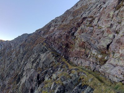
Day 2 – Wake early, and climb from the lakes to Comanche pass, 12,719 feet where we'll have stunning views of the Crestones and surrounding peaks. Continue on a relatively flat path until we reach Phantom Terrace and see why it has that name: you can't see it until you are on it! This traverse is not dangerous in most conditions and does not require any scrambling. The footing is good, although the terrace is relatively narrow for about 200 yards. After crossing Phantom Terrace and descending some, we'll climb back to Venable Pass (12,796) and then make a long descent through lush aspen groves that follow the North Fork of Crestone Creek. We'll eventually reach our lowest altitude for the day, about 9800 feet, before turning east on the western side of the Comanche Trail. We'll climb up this relatively steep trail for about 2 miles at which point we'll make our decision to stage camp for the night or to press on until Venable Lakes (preferred option). If we chose to camp the mileage for the day will be about 8 miles and about 2200 feet of gain/descent. If we continue (preferred) we'll gain another 1000 feet back to Comanche Pass, retrace our steps toward Phantom Terrace, cross the terrace again, and descend to Venable lakes for camp. If we take the preferred option to Venable Lakes, total mileage will be 13 with about 3300 of gain.
Day 3 – If we stayed below Comanche Pass, rise early and complete the climb to Comanche Pass before crossing over Phantom Terrace and descending to Venable Lakes (about 4 miles, 1000 feet gain). Once at Venable Lakes, follow the Venables Creek to Venable Falls about 2 miles, enjoy this lovely waterfall, and then conclude our hike by descending another 2.3 miles to the trailhead.
- Suitable Activities: Backpacking
- Seasons: July, August, September
- Weather: View weather forecast
- Difficulty: Difficult
- Length: 20.3 mi
- Elevation Gain: 6,800 ft
- 13,226 ft
-
Land Manager:
U.S. Forest Service
Sangre de Cristo Wilderness Area, San Carlos Ranger District (PSINF)
- Parking Permit Required: USFS Permits & Passes
- Recommended Party Size: 6
- Maximum Party Size: 12
- Maximum Route/Place Capacity: 12
- Trails Illustrated 138
There are no resources for this route/place. Log in and send us updates, images, or resources.
