BPX 3-Day: McCurdy Park Loop from Goose Creek TH
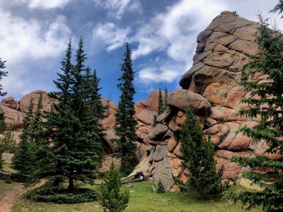
In her book, The Best Hikes in Colorado, Christina Williams writes: “Giant rock formations tower above the landscape, creating an individuality and wild grandeur rarely found so close to large centers of population.” This difficult 24-mile loop sees a lot of gain and loss, but also a lot of amazing rock formations, historic structures, and unique landscapes. Refrigerator Gulch sits at the north side of this loop and makes for endless exploration opportunities.
Hike this loop clockwise starting at the bottom, making Day 1 the longest day with 10 miles. Note: Once you leave Hankins Pass Trail and head up Lake Park trail on Day 1, you might not have water access until you reach the Brookside McCurdy Trail at the end of Day 1. Make sure you have 2-3 liters of water before leaving Hankins Pass trail in summer and fall.
Suggested Backpacking Section (BPX) itinerary for 3-day trip to be used for CMC trips led by BPX leaders for BPX members: Day 1. From the Goose Creek Trailhead climb steadily on the Hankins Pass Trail 4.4 miles to Hankins pass and then another 2.1 miles on the Lost Park Trail to the highpoint of the trip. Then descend as much as 3.5 miles to lovely McCurdy Park for a total of 10 miles. (10 miles/3600’)
Day 2. . From McCurdy Park, descend to the main crossing of Lost Creek, finding some particularly scenic and interesting spots, including the place where Lost Creek is "lost" and goes underground, and then hike up to the junction with Goose Creek Trail and pick one of several camping areas along the Goose Creek Trail after the junction. (8 miles/1000’)
Day 3 On the shortest hiking day, hike out to the trailhead, stopping to visit the historic buildings and the scenic areas on the spur trail to the Shafthouse. (6 miles/600’).
Driving Directions: Take US 285 to Pine Junction and turn south onto County Road 126. Drive for 21.8 miles. Just south of Wigwam Campground, take a right (west) on FR 211, following the signs for Cheesman Lake and Goose Creek Campground. After 2.0 miles, turn right for Lost Valley Ranch and Goose Creek Campground. Go west for 1.1 miles, stay left at a fork in the road and continue for another 5.2 miles. At a junction past Molly Gulch Campground, turn right for Goose Creek Campground. Drive 4.7 miles, bearing left when Forest Road 51 descends to the right. Cross Goose Creek and pass Goose Creek Campground. Head right onto the Goose Creek Trailhead access road and drive for 1.3 miles to the large parking area. NOTE: High clearance 4WD recommended
General Requirements: The first day will be very difficult. On the second day, depending on the water levels, the crossing of Lost Creek may involve a group effort to ford in deep water. A self-issue permit is required at the trailhead.
Map:
- Suitable Activities: Backpacking
- Seasons: June, July, August, September, October
- Weather: View weather forecast
- Difficulty: Difficult
- Length: 24.0 mi
- Elevation Gain: 5,200 ft
-
Land Manager:
U.S. Forest Service
Lost Creek Wilderness Area, South Platte Ranger District (PSINF)
- Parking Permit Required: USFS Permits & Passes
- Recommended Party Size: 7
- Maximum Party Size: 12
- Maximum Route/Place Capacity: 12
- Trails Illustrated 105, 135
There are no resources for this route/place. Log in and send us updates, images, or resources.
