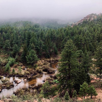
BPX 3-Day: Goose Creek Trail to Shafthouse from Goose Creek TH
An easy out-and-back over 3 days allows for an exploration of the historic Shafthouse area in Lost Creek Wilderness from a basecamp. Discover unusual rock formations, early 20th century buildings, a canyon, and some fishing/wading pools along Goose Creek.
This trip takes you to the Shafthouse area off Goose Creek Trail (#612). Find a good campsite and you’ll spend 2 nights in the same spot, allowing a full day for exploring the area. To/from camp the trip is 8 miles roundtrip; you can add another 4 miles with a lighter pack on the exploration day. Things to discover here: historic cabins, a climb beyond the cabins to a scenic overlook that is a good spot for sunrise/sunset, caves and boulders, then continue on the Shafthouse trail into the canyon where people attempted to build a dam in the 20th century–you can still find some equipment along the trail. Back at the cabins, if you go south/downhill along the drainage through a series of campsites, you’ll eventually run into the Goose Creek, which flows fast over big boulders and then smooths out into wide, placid pools that are great for fishing and cooling off your feet. Social trails are all over here and it is a very popular area – start early, go on weekdays, and avoid the campsites right on the creek.
Suggested Backpacking Section (BPX) itinerary for 3-day trip to be used for CMC trips led by BPX leaders for BPX members:
Day 1: From the Goose Creek TH, take Goose Creek Trail (#612). Hike through the woods 3.8 miles to the Shaft House. Find a campsite. Visit the historic buildings (3.8 miles, +897 / -519 ft.).
Day 2: Hike and explore from/to campsite with light pack along the Goose Creek TH. (4 miles, +-1,008 ft.).
Day 3: Break camp, hike out, and drive home (3.8 miles, +519 / -897 ft.).
Overall Route: 7.6 miles, +-1,417 ft.
NOTES:
- Always practice Leave No Trace techniques.
- More information about Lost Creek Wilderness is available here.
- Water in late summer can be limited unless you go all the way downhill to Goose Creek (the big creek).
- It also gets hot here; earlier season trips recommended.
- General Requirements: This can be a very busy trail so mid-week would be preferable to escape the crowds. Water level varies. If very dry, may need to camp at 1.5 miles or 4.5 miles from trailhead because there may not be water at Shaft House. A self-issue permit is required at the trailhead.
- Driving Directions: Take US 285 to Pine Junction and turn south onto County Road 126. Drive for 21.8 miles. Just south of Wigwam Campground, take a right (west) on FR 211, following the signs for Cheesman Lake and Goose Creek Campground. After 2.0 miles, turn right for Lost Valley Ranch and Goose Creek Campground. Go west for 1.1 miles, stay left at a fork in the road and continue for another 5.2 miles. At a junction past Molly Gulch Campground, turn right for Goose Creek Campground. Drive 4.7 miles, bearing left when Forest Road 51 descends to the right. Cross Goose Creek and pass Goose Creek Campground. Head right onto the Goose Creek Trailhead access road and drive for 1.3 miles to the large parking area.
- Driving Directions: From the Colorado Mountain Club (Golden, CO) to the Goose Creek TH.
- Suitable Activities: Backpacking
- Seasons: June, July, August, September, October
- Weather: View weather forecast
- Difficulty: Easy
- Length: 7.6 mi
- Elevation Gain: 1,417 ft
- 8,766 ft
-
Land Manager:
Land Manager Varies
Lost Creek Wilderness Area, South Platte Ranger District (PSINF)
- Parking Permit Required: Other
- Recommended Party Size: 6
- Maximum Party Size: 12
- Maximum Route/Place Capacity: 12
There are no resources for this route/place. Log in and send us updates, images, or resources.
