BPX 3-Day: Continental Divide and Red Canyon
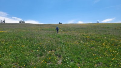
This is a difficult loop trip in the Mount Zirkel Wilderness area to a beautiful subalpine basin and tundra walk along Continental Divide and descent through spectacular Red Canyon where Rocky Mountain Bighorn Sheep range. Total distance is 16.2 miles with 3,800 feet elevation gain with second day almost entirely above tree line.
Suggested Backpacking Section (BPX) itinerary for 3-day trip to be used for CMC trips led by BPX leaders for BPX members.
First night will be in meadow area located in cirque below continental divide. Second day climbs up to divide for a walk south on CDT/Wyoming trail to camp on divide if weather permits or large plateau just below tree line if required due to threatening thunderstorms. Final day descends into beautiful Red Canyon and then north on Grizzly Helena trail back to cars.
Day 1 – Meet and drop car(s) at Lone Pine South TH and pile into remaining cars or shuttle as required 1.4 miles to Lake Katherine TH or just walk it. Hike up Lone Pine Trail 1129 staying right past forks for Lake Katherine and then Bighorn Lake to large basin just before climb to Continental Divide. Trail just before basin may be difficult to follow but goal is creek crossing at lower end of basin where trail becomes more obvious. (2.7 miles, 1,240 feet up, 140 down). Watch for elk which are frequently in this basin. Bear sited in the area on 2022 trip.
Day 2 – Continue west oute Day 1on 1129 to Continental Divide Wyoming Trail 1101 – trail is step and holds snow until mid to late July. Proceed south along divide (maximum elevation 11,200 ft) past Three Island trail 1163 turnoff and North Lake trail 1164 turnoff and descend slightly before reaching Lost Ranger trail 1131. At trail intersection there is small shallow stream and camping sites if the weather is perfect, otherwise continue down Lost Ranger trail to other small streams and camping below tree line. Route shown to last small creek before descent into canyon. (6.8 miles/+1,400/-1,400 feet).
Day 3 –Descend on Lost Ranger into Red Canyon – lots of brushes encroaching on trail, so long pants recommended. At bottom go left/north on Grizzly Helena 1126 with jog at Red Canyon TH (4WD) to return to car at Lone Pine South trailhead. There is a creek crossing just before reaching trailhead – would be swift water early season but OK by mid-July. (6.8 miles/+1,200/-2,500 feet).
Notes:
Lower sections of trails have Aspen so could be good for fall colors.
Lone Pine South TH has limited parking and Katherine TH has larger parking area.
- Suitable Activities: Backpacking
- Seasons: July, August, September
- Weather: View weather forecast
- Difficulty: Difficult
- Length: 16.2 mi
- Elevation Gain: 3,800 ft
- 11,161 ft
-
Land Manager:
U.S. Forest Service
Mount Zirkel Wilderness Area, Parks Ranger District (RNF)
- Parking Permit Required: USFS Permits & Passes
- Recommended Party Size: 6
- Maximum Party Size: 15
- Maximum Route/Place Capacity: 15
- Trails Illustrated 117
There are no resources for this route/place. Log in and send us updates, images, or resources.
