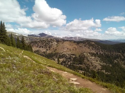
BPX 3-Day: Colorado Trail - Segment 9 from Wurtz Ditch TH to Timberline TH
Alternate ascents to passes and descents to creeks and rivers on this segment of the Colorado Trail. Great views of the Arkansas River Valley and the Mosquito Range, the Sawatch Range, and Mount Massive. Shuttle back to starting point. Easy trip with total 10.6 miles and 2,178ft elevation gain
Suggested Backpacking Section (BPX) itinerary for 3-day trip to be used for CMC trips led by BPX leaders for BPX members
We will set up a shuttle between Wurtz Ditch TH (or Tennessee Pass TH) and Timberline TH.
Day 1: Drive to Wurtz Ditch TH. ( Note that parking is free style amongst the trees (not a formal lot). There is typically plenty of space for 6 cars or so. Alternate parking is at the Tennessee Pass TH but the hike from here to the Ditch is not that great. Hike along the gravel road from the TH for 0.2mile to the CT crossing and turn right onto the CT. Hike to the junction with Longs Gulch (#1776) and find camping. The climb out of the gulch is significant and better left for being fresh next day and then you can have the entire day to enjoy the high country. There is very good wide open camping area in the Gulch. (3.25 miles/ 620ft elevation)
Day 2: Continue along the CT, hike up to Porcupine Lakes (watch out for mosquitos) and continue up and down to Bear Lake and find camping at Bear Lake. (4.25 miles/ 980ft elevation)
Day 3: Continue to the Timberline Lake TH and the end of Segment 9. (3miles/ 880 ft elevation). Shuttle back to starting point
Driving Directions:
Drive north from Leadville on US 24 for about 7.5 miles to Wurtz Ditch Road (FS 705). Proceed about 1 mile on this gravel road to an intersection and turn right. Proceed 0.3mile to CT crossing. Parking space is limited.
- Suitable Activities: Backpacking
- Seasons: June, July, August, September, October
- Weather: View weather forecast
- Difficulty: Easy
- Length: 10.6 mi
- Elevation Gain: 2,178 ft
- 11,720 ft
-
Land Manager:
U.S. Forest Service
Holy Cross Wilderness Area, Leadville Ranger District (PSINF)
- Parking Permit Required: USFS Permits & Passes
- Recommended Party Size: 6
- Maximum Party Size: 12
- Maximum Route/Place Capacity: 12
- Trails Illustrated 109
- Trails Illustrated 126
There are no resources for this route/place. Log in and send us updates, images, or resources.
