BPX 3-Day: Colorado Trail - Segment 21 Spring Creek Pass TH to San Luis Pass TH
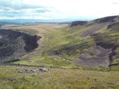
Hike on the Colorado Trail along the edge of the remote La Garita Wilderness from Spring Creek Trailhead to San Luis Pass. Experience unusual terrain on Snow Mesa and grand views above the pass. This portion of the La Garita Wilderness is known for its wildlife, wildflowers, volcanic pinnacles, and extensive vistas.
Suggested Backpacking Section (BPX) itinerary for 3-day trip to be used for CMC trips led by BPX leaders for BPX members
Day 1. Drive to San Luis Pass TH and leave all but one car here. Next best is to park at the mine which is about 2 miles from the TH as the road is a very rutted 4WD road. Drive one car to Spring Creek Pass TH and car camp here.
Day 2. Start the hike on the Colorado Trail across scenic Snow Mesa. Camp at one of the branches of Mineral Creek.(10 miles/2200’)
Day 3. Continue hiking over a high ridge above treeline, down to the pass and down on the San Luis Pass Trail to the cars above Creede. (6 miles/1700’)
Driving Directions: From Denver, drive on Route 285 to Poncha Springs, take Route 50 to Gunnison. Take Route 149 to Lake City. From Lake City, continue on Route 149 to Spring Creek Pass.
San Luis Pass Trailhead: From the town of Creede, CO travel North on Forest Road 503 straight up West Willow Creek for 8 miles. At the point where Forest Road 504 turns off to the left heading west up the hill, park your vehicle. The San Luis Pass trail continues up West Willow Creek to the Divide.
General Requirements: This will require setting up a shuttle. It is possible to car camp at Spring Creek Pass. An additional day for a straightforward climb of San Luis Peak is possible.
- Suitable Activities: Backpacking
- Seasons: July, August, September
- Weather: View weather forecast
- Difficulty: Difficult
- Length: 16.0 mi
- Elevation Gain: 3,900 ft
- 12,879 ft
-
Land Manager:
U.S. Forest Service
La Garita Wilderness Area, Divide Ranger District (RGNF)
- Parking Permit Required: USFS Permits & Passes
- Recommended Party Size: 6
- Maximum Party Size: 12
- Maximum Route/Place Capacity: 12
- Trail Illustrated 139
There are no resources for this route/place. Log in and send us updates, images, or resources.
