BPX 3-Day: Bear Lakes and Flattop Mtn. from Lone Pine North TH
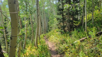
Ascend through aspen and pine forests up the Bear Creek drainage past old mines to reach Bear Lakes just at timberline in a cirque below the Continental Divide with two lakes for camping.
From camping at Bear Lakes it is 1.4 miles and 700 vertical feet to Ute Pass and opportunities to explore the high country.
Suggested Backpacking Section (BPX) itinerary for 3-day trip to be used for CMC trips led by BPX leaders for BPX members:
Day 1 - Starting from the Lone Pine North TH head north on the Grizzly Helena trail and cross Bear Creek. After crossing creek look for trail going up the valley. A short distance past the junction are old mines and remains of cabins. Continue to follow creek up the valley along trail which may be difficult to find in upper sections due to reroutes onto southern side of hill to avoid marshy area. The turn-off for Bear Lakes is just before step climb up to Ute Pass. 5.9 miles and 2,100 vertical feet to the lakes.
Day 2 - Explore lake area or optional second day hike to climb up to Ute Pass on the divide and explore and to top of Flattop Mountain. Just past top of pass look for Ute pass trail going north along divide and follow that to just before it descends. Head north going cross-country following ridge to top of Flattop Mountain at 11,749 feet which is a steep climb - 45 percent grade - towards end of climb just before the summit. Continue north west along the nearly flat top of the range and check out lakes seen below on east side and views of Big Agnes and Mt. Zirkel to the west. Return via same route to lakes for second night. Additional 7.5 miles and 2,000 vertical feet round trip to north end of Flattop.
Day 3 - Return to trailhead via Bear Creek trail and Grizzly Helena trail.
Note: Additional parking can be found at Lake Katherine TH further up the road.
- Suitable Activities: Backpacking
- Seasons: July, August, September
- Weather: View weather forecast
- Difficulty: Difficult
- Length: 11.8 None
- Elevation Gain: 2,700 ft
- 10,680 ft
-
Land Manager:
Land Manager Varies
Mount Zirkel Wilderness Area, Parks Ranger District (RNF)
- Parking Permit Required: Other
- Recommended Party Size: 6
- Maximum Party Size: 12
- Maximum Route/Place Capacity: 12
- Trail Illustrated 116
This is a list of titles that represent the variations of trips you can take at this route/place. This includes side trips, extensions and peak combinations. Not seeing a title that fits your trip? Log in and send us updates, images, or resources.
- BPX 2-Day: Bear Lakes from Lone Pine North TH
There are no resources for this route/place. Log in and send us updates, images, or resources.
