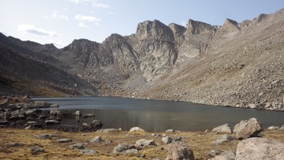
BPX 3-Day: Abyss and Helms Lakes from Bierstadt TH to Burning Bear TH
This moderate, 16.6 mile point-to-point shuttle hike begins at Bierstadt TH, visits Helms Lake and Abyss Lake, and ends at the Burning Bear TH. It features more net elevation loss than gain (3,300 ft. lost on final day). Enjoy views of MT. Bierstadt, Mt Evans, and some alpine lakes on this fun one-way trip that requires setting up a car shuttle.
Suggested Backpacking Section (BPX) itinerary for 3-day trip to be used for CMC trips led by BPX leaders for BPX members: Set up a car shuttle between Bierstadt TH and Burning Bear East TH. Trailheads are about 15 minutes apart by car.
Day 1: Hike from Bierstadt TH along Rosalie Trail (#603) to the trail junction with the Abyss Lake Trail (#602). Turn left on the Abyss Lake Trail (#602) and take it to small lakes and find a suitable camp. (6.1 miles, +1,300 / -1,200 ft.)
Day 2: Hike to and camp near Abyss Lake (Elevation 12,670 ft.) (2.25 miles, +930 ft.)
Day 3: Break camp and hike out to Burning Bear East TH (8.25 miles, +270 / -3300 ft.)
Overall Route: 16.6 miles, +2,420 / -4,445 ft.
NOTES:
- Always practice Leave No Trace techniques.
- More information about Mt. Evans Wilderness is available here.
- This trip requires a car shuttle between Bierstadt TH and Burning Bear East TH. The trailheads are about 15 minutes apart by car.
- Driving Directions: From the Colorado Mountain Club (Golden, CO) to the Bierstadt TH.
- Suitable Activities: Backpacking
- Seasons: July, August, September
- Weather: View weather forecast
- Difficulty: Moderate
- Length: 16.6 mi
- Elevation Gain: 2,420 ft
- 12,670 ft
-
Land Manager:
U.S. Forest Service
Mount Blue Sky Wilderness Area (formerly Mount Evans), South Platte Ranger District (PSINF)
- Parking Permit Required: USFS Permits & Passes
- Recommended Party Size: 7
- Maximum Party Size: 12
- Maximum Route/Place Capacity: 12
- Trails Illustrated 104
There are no resources for this route/place. Log in and send us updates, images, or resources.
