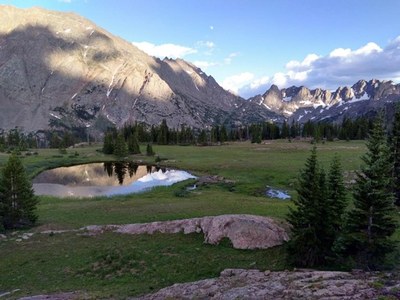
BPX 2-Day: Upper Cataract Lake from Eaglesmere TH
Hike to a beautiful lake in a scenic basin below high peaks, including Eagles Nest Peak, in the Eagles Nest Wilderness. Lollipop route is 12.2 miles and 2,830 vertical feet.
Suggested Backpacking Section (BPX) itinerary for 2-day trip to be used for CMC trips led by BPX leaders for BPX members:
Day 1: Start at Eaglesmere TH, on the Eaglesmere Trail (#61) and hike up to the Gore Range Trail (#60). Turn left (south) and head west past Tipperary Lake and on to Cataract Trail (#63). Head up to Upper Cataract Lake and set up a campsite near the lake. (7.25 miles, +2,656 / -702 ft.)
Day 2: Head back down Cataract Trail (#63) to the Gore Range Trail (#60). Turn right and travel past Surprise Lake to Surprise Trail (#62), turn left and head down to the Surprise Lake TH and walk to the Eaglesmere TH. (5.6 miles, +335 / -2,375 ft.).
Overall Route: 12.2 miles, +-2,830 ft.
NOTES:
- Always practice Leave No Trace techniques.
- More information about Eagles Nest Wilderness is available here.
- Campfires are not permitted at Upper Cataract Lake (Stoves only).
- Bear canister or bear bag is required.
- Driving Directions: From the Colorado Mountain Club (Golden, CO) to the Eaglesmere TH.
- Suitable Activities: Backpacking
- Seasons: June, July, August, September
- Weather: View weather forecast
- Difficulty: Difficult
- Length: 12.2 mi
- Elevation Gain: 2,830 ft
- 10,893 ft
-
Land Manager:
U.S. Forest Service
Eagles Nest Wilderness Area, Dillon Ranger District (WRNF)
- Parking Permit Required: USFS Permits & Passes
- Recommended Party Size: 6
- Maximum Party Size: 12
- Maximum Route/Place Capacity: 12
- Trails Illustrated 108
There are no resources for this route/place. Log in and send us updates, images, or resources.
