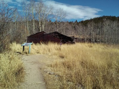
BPX 2-Day: Fraser Meadows from Horseshoe TH
Early season and close in trip to Golden Gate Canyon State Park with camping at Frazer Meadows. Could be after work backpacking trip with varied hike out the following day. Easy trip with only 5.2 miles out and back 1,300 feet elevation gain.
Suggested Backpacking Section (BPX) itinerary for 2-day trip to be used for CMC trips led by BPX leaders for BPX members:
Day 1 – Hike 1.8 miles up Horseshoe trail to Rim, Greenfield or Frazer Meadows for camping. (1.8 miles, 900 feet up, 0 down).
Day 2 – Hike out, take Mule Deer to Black Bear stop at Ralston Roost and continue on Black Bear to intersect the lower part of Horseshoe and return to TH (3.3 miles, 400 feet up, 1,300 down).
Note: Option to hike back along the same trail as Day 1.
Driving Directions: From Golden north on highway 93 approximately 1 ½ miles, left on Golden Gate Canyon Rd. 12.7 miles to park entrance, right short distance to check-in at Visitor Center and then 0.4 miles to Horseshoe TH.
General Requirements: Check with State Park at (303) 582-3707 for latest conditions including water availability. Stoves only, no open fires. Reservations and State Parks Pass required.
Golden Gate Canyon State Park Map
- Suitable Activities: Backpacking
- Seasons: Year-round
- Weather: View weather forecast
- Difficulty: Easy
- Length: 5.2 mi
- Elevation Gain: 1,300 ft
- 9,327 ft
-
Land Manager:
Colorado Parks & Wildlife
Golden Gate Canyon State Park
- Parking Permit Required: State Parks Entrance Fee / Pass
- Recommended Party Size: 6
- Maximum Party Size: 12
- Maximum Route/Place Capacity: 12
- Trails Illustrated 100
There are no resources for this route/place. Log in and send us updates, images, or resources.
