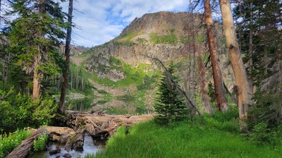
BPX 2-Day: Bighorn Lake from Lake Katherine TH
This is an out and back, moderately difficult trip in the Mount Zirkel Wilderness area to a beautiful subalpine lake just below the Continental Divide. The trail starts at the Katherine TH and is 5.0 miles and 1,200 elevation gain RT.
Suggested Backpacking Section (BPX) itinerary for 2-day trip to be used for CMC trips led by BPX leaders for BPX members:
Day 1: Start a Katherine TH which has amble parking. Hike up Lone Pine Trail (#1129) past left fork for Lake Katherine to left fork for Bighorn Lake trail (1040) to Bighorn Lake (10,200 ft.) (2.5 miles, +1,212 / -110 ft.). There are camp sites on the north and south sides of outlet from the lake.
Day 2: Return on Lone Pine Trail to Katherine TH and drive home
NOTES:
- Always practice Leave No Trace techniques.
- More information about the Mount Zirkel Wilderness is available here.
- Driving Directions: From the Colorado Mountain Club (Golden, CO) to the Katherine TH.
- Suitable Activities: Backpacking
- Seasons: July, August, September
- Weather: View weather forecast
- Difficulty: Moderate
- Length: 5.0 mi
- Elevation Gain: 1,200 ft
- 10,200 ft
-
Land Manager:
U.S. Forest Service
Mount Zirkel Wilderness Area, Parks Ranger District (RNF)
- Parking Permit Required: USFS Permits & Passes
- Recommended Party Size: 6
- Maximum Party Size: 15
- Maximum Route/Place Capacity: 15
- Trails Illustrated 117
There are no resources for this route/place. Log in and send us updates, images, or resources.
