BPX 3-Day: Lost Park from Rolling Creek TH
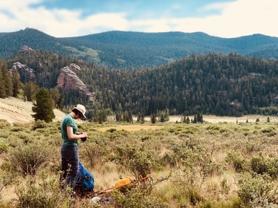
This 25-mile loop in Lost Creek Wilderness includes a steep climb to a no-name pass, creek crossings, long meadow walks, beaver ponds, and pretty spots along Lost Creek and North Fork Lost Creek. It's a good early season backpack, as snow should be melted out by mid June.
Suggested Backpacking Section (BPX) itinerary for 3-day trip to be used for CMC trips led by BPX leaders for BPX members.
Day 1: Meet up in the afternoon and carpool to Rolling Creek TH. Hike the Rolling Creek TH (#663), a lesser-used trail, for 2 miles to the south. Look for a large rock formation on the left with a campsite. There are other campsites in the area as well. The creeks nearby can be seasonal, and may require a 1/4 to 1/2 mile walk depending on campsite selection. Make camp for the night. (2 miles, +240 ft.)
Day 2: Continue south on Rolling Creek TH (#663). About 1 past the campsite (3 miles from TH), the trail will start to climb up a canyon with a creek running in it. This climb will continue for 2 miles and is steep, and the trail can be tough to follow but there's only one way up the narrow canyon, following the creek. Enjoy this challenge! Around mile 3 for the day, you will reach the top of a wooded pass. There could be snow here, depending on time of year. Enjoy a breather, then continue south. You will intersect the Wigwam Trail (#609) at the bottom of the hill. There are good campsites here, should you opt for a 3 day hike and end Day 1 here. Beaver ponds are also nearby. Make a right and head west on Wigwam Trail (#609). The trail is relatively flat and passes through meadows at the bottom of a long valley. You will enter a series of valleys called East Lost Park. Around Mile 11 for the day, you enter a wooded area on the creek with large boulders and nice campsites. Make camp here for a shorter Day 2 (11 miles, +3,233 / -1,649 ft.) or continue on for a longer Day 2. For that option, take the Wigwam Trail (#609) northwest to Lost Park Campground, and from there pick up the Brookside McCurdy Trail (#607) and go north to the North Fork TH area. There are many campsites near North Fork and a good water source. Make camp for the night (14.4 miles, +3,779 / -1,815 ft.).
Day 3: If you camped east of Lost Park, take the Wigwam Trail (#609) west to Brookside McCurdy Trail (#607). Take that north to the Colorado Trail (Section 4). Hike the Colorado Trail east back to Rolling Creek TH (Shorter Day 3: 8.7 miles, +659 / -2,582 ft.) (Longer Day 3: 11.9 miles, +1,121 / -2,678 ft.)
Overall Route: 25 miles, +-4,480 ft.
NOTES:
- Always practice Leave No Trace techniques.
- More information about the Lost Creek Wilderness is available here.
- This itinerary is more of a 2.5 day option, designed for Friday night starts. The loop can also be done in 2 or 3 full days, but campsites will differ from above.
- Driving Directions: From the Colorado Mountain Club (Golden, CO) to the Rolling Creek TH.
- Suitable Activities: Backpacking
- Seasons: June, July, August, September, October
- Weather: View weather forecast
- Difficulty: Challenging
- Length: 25.0 mi
- Elevation Gain: 4,480 ft
- 10,661 ft
-
Land Manager:
U.S. Forest Service
Lost Creek Wilderness Area, South Platte Ranger District (PSINF)
- Parking Permit Required: USFS Permits & Passes
- Recommended Party Size: 6
- Maximum Party Size: 12
- Maximum Route/Place Capacity: 12
This is a list of titles that represent the variations of trips you can take at this route/place. This includes side trips, extensions and peak combinations. Not seeing a title that fits your trip? Log in and send us updates, images, or resources.
- BPX 2-Day: Lost Park from Rolling Creek TH
There are no resources for this route/place. Log in and send us updates, images, or resources.
