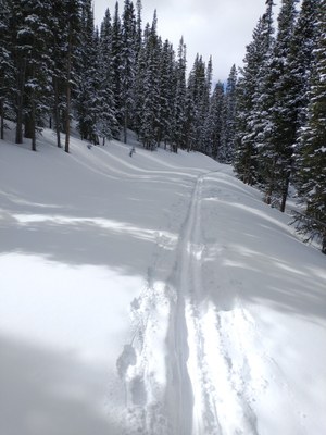
Bakerville - Loveland Trail
This is a 10 mile, 1,128' elevation gain, out-and-back route from Bakerville to the Loveland Ski Area that runs parallel to I-70.
Click here and here for more information about this route.
Thanks to heavy tree cover, this route, which is an asphalt paved bike trail during warmer months of the year, becomes a nice wide snowpacked trail during the winter months, suitable for cross-country skiing, snowshoeing, and fat biking. The turn off at Herman Gulch (3.2 miles, 666') is a good turnaround point for those interested in a shorter version of the trip.
- Suitable Activities: Biking, Hiking, Nordic Skiing, Snowshoeing
- Snowshoeing Category: Intermediate
- Seasons: Year-round
- Weather: View weather forecast
- View avalanche forecast.
- Length: 10.0 mi
- Elevation Gain: 1,128 ft
- 10,688 ft
-
Land Manager:
U.S. Forest Service
Clear Creek Ranger District (ARNF)
- Parking Permit Required: USFS Permits & Passes
- Recommended Party Size: 12
- Maximum Party Size: 12
- Maximum Route/Place Capacity: 12
There are no resources for this route/place. Log in and send us updates, images, or resources.
