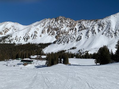
Arapahoe Basin
Arapahoe Basin Ski Area provides opportunities for lift served downhill skiing, uphill skiing, skimo races and access points for the back country. The vertical gain from base to summit is 2500 feet with a maximum of elevation of 13,050 feet.
A variety of trails and ski roads connect the base to the top of the Arapahoe Basin Ski Area with a typical route being about 2 miles one way. The high point is Lenawee Mountain at 13,050 feet. The statistics for the ski area itself are:
TERRAIN
- Number of trails: 147
- Vertical drop: 2,530 feet (771 meters)
- Acres: 1,428
- EASIEST (GREEN): 7%
- MORE DIFFICULT (BLUE): 20%
- MOST DIFFICULT (BLACK): 49%
- EXTREME (DOUBLE-BLACK): 24%
- Suitable Activities: Backcountry Skiing/Splitboarding, Resort Skiing/Snowboarding
- Seasons: January, February, December
- Weather: View weather forecast
- Avalanche Terrain Rating Simple View avalanche forecast.
- Length: 3.0 mi
- Elevation Gain: 2,000 ft
- 12,474 ft
-
Land Manager:
U.S. Forest Service
Dillon Ranger District (WRNF)
- Parking Permit Required: USFS Permits & Passes
- Recommended Party Size: 12
- Maximum Party Size: 12
- Maximum Route/Place Capacity: 12
This is a list of titles that represent the variations of trips you can take at this route/place. This includes side trips, extensions and peak combinations. Not seeing a title that fits your trip? Log in and send us updates, images, or resources.
- Arapaho Basin Skimo
- Arapaho Basin Rando
- Arapahoe Basin Uphill Skiing
There are no resources for this route/place. Log in and send us updates, images, or resources.
