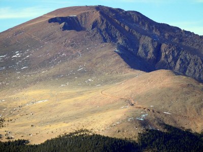
Almagre Mountain
This hike follows FSR 379, then FSR 379A to Mount Baldy Reservoir, where the branch to the right leads to Almagre Mountain summit (12,367 ft). Alluring views of Pikes Peak, the Cog, Colorado Springs, North Cheyenne Canon, Mays Peak, as well as Mason and McReynolds Reservoirs can be had from the trail and summit.
A high-clearance vehicle is necessary to access the Portal 9 (Frosty Park) Trailhead, or you can park at the intersection of Gold Camp Rd. and FSR 379, then hike approximately 1.6 miles down FSR 379 to the trailhead.
From the trailhead, FSR 379 gradually ascends for about 0.6 miles to a clearing that overlooks Jones Park. From the overlook, the trail takes a hard left and starts to meander and gain more elevation along the edge of timbers. Deer Park, noted by its wetlands, is about 1.3 miles down the road after it starts to swing around to the north. Soon after passing Deer Park is another clearing that comprises the intersection of FSR 379A.
Take a sharp right to access the beginning of FSR 379A. At this point, FSR 379A continues along the timbered ridgeline for about 1.5 miles before it begins a steep ascent. FSR 379A has some blind curves for motorized vehicles, so hikers should be vigilant.
Continue the ascent for another quarter mile to the locked gate. Motorized vehicles are not allowed past the locked gate due to the fragile ecosystem. Go around the locked gate and head to the right over the old brick dam (Mount Baldy Dam). From here, it is another 1.25 miles to the summit.
- Suitable Activities: Hiking
- Seasons: Year-round
- Weather: View weather forecast
- Difficulty: Moderate
- Elevation Gain: 2,535 ft
-
Land Manager:
U.S. Forest Service
Pikes Peak Ranger District (PSINF)
- Parking Permit Required: USFS Permits & Passes
- Recommended Party Size: 12
- Maximum Party Size: 12
- Maximum Route/Place Capacity: 12
- caltopo
There are no resources for this route/place. Log in and send us updates, images, or resources.
