Trip
RMOTHG Trip – Kenosha Pass East
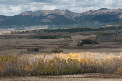
Starts at Kenosha Pass and travels SE along the Colorado Trail (Last part of Segment 5) to a lunch spot with open views. This is a fairly easy (if minimal snow & not on snowshoes) rolling route that will end on a high point, passing through aspen groves with views over Jefferson Valley and the mountains to the south and west.
- Thu, Jan 30, 2025
- Rocky Mountain Over the Hill Gang
- Hiking, Snowshoeing
- Adults
- Moderate
- Moderate
- Mileage: 6.0 mi
- Elevation Gain: 700 ft
- High Point Elevation: 10,422 ft
- Pace: Casual Plus ( 1.5 mph ) Steady Pace
- 5 (11 capacity)
- Cancellation & Refund Policy
RTD Twin Forks Park n Ride: 6164 US Highway 285, Morrison, CO
From the "285 South" exit of 470 (Exit 5A) drive approximately 5 miles and look for turn-off on the left. We will carpool from here for 48 miles (approximately 1 hour in good road conditions) to Kenosha Pass South side.
I will update weather and trail conditions over email the day before the hike. This might be a spike hike or a snowshoe; I will let you know as we get closer. No avy risk on this trail.
I haven't done this trail in winter before, so be prepared to explore it with me!
Option to stop for lunch at Snowpack Taproom in Conifer on the return drive. Great spot for sandwiches, soups, salads, pizza & beer.
I would welcome a Co-Leader! Please let me know if you are interested.
Required Equipment
Be prepared for any Winter conditions.
$15 annual RMOTHG Membership Dues are required to participate. Please contact the office at 303-279-3080 ext. 3 or office@cmc.org to join!
