Trip
RMOTHG Trip – Chapman Drive to May's Point
Chapman Drive to May's Point
- Tue, Nov 26, 2024
- Rocky Mountain Over the Hill Gang
- Hiking
- Adults
- Moderate
- Moderate
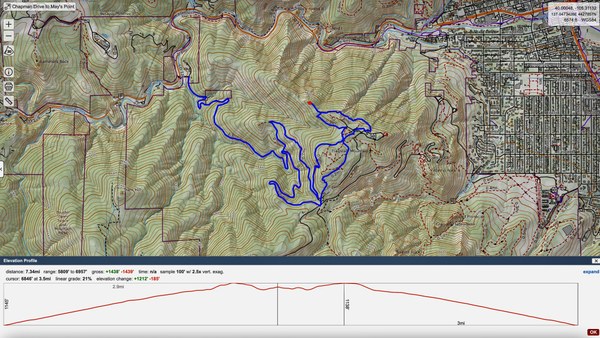
- Mileage: 7.3 mi
- Elevation Gain: 1,440 ft
- High Point Elevation: 6,960 ft
- Pace: moderate
- FULL, 3 on waitlist (11 capacity)
- Cancellation & Refund Policy
Clear Creek Parking Lot, 10th & Archer St, Golden - 7:30AM
https://www.google.com/maps/place/Clear+Creek+Parking+Lot/@39.7600935,-105.2194803,19.36z/data=!4m6!3m5!1s0x876b855132b75051:0x2593a4a86c532ab7!8m2!3d39.7601511!4d-105.2190801!16s%2Fg%2F11s1zk4hst?entry=ttu&g_ep=EgoyMDI0MTExOS4yIKXMDSoASAFQAw%3D%3D
If you prefer to meet us in South Boulder, please email me and I will forward you the information. Meeting time will be 8:00AM
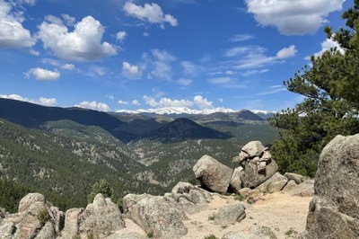
Chapman Drive is a lovely forested hike up an old access road to Flagstaff Mountain. Bikes are allowed, but it's nice and wide. We will hike up to our lunch spot at May's Point, which has a great view of the Continental Divide. It is sort of a big slick rock area, with boulders to walk around and an area or two of very minor "scrambling" (you may want to use your hands for two or three steps) There is no exposure on the trails. Some parts of the trail have loose gravel, we will take our time on these areas.

Required Equipment
$15 annual RMOTHG Membership Dues are required to participate. Please contact the office at 303-279-3080 ext. 3 or office@cmc.org to join! If you are interested in trying out RMOTHG before you join, please email Jeanne.
Trekking Poles, MICROSpikes, Lunch, 2 liters of water, the rest of the 10 Essentials

