Trip
Intermediate Snowshoe – Jones Pass
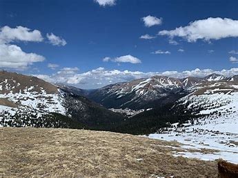
We'll snowshoe the first mile along the Jones Pass Road to the top of the valley floor, then proceed off the road and along the West Fork of Clear Creek and ascend toward the Continental Divide. Conditions of the day and feeling of the group will dictate our turnaround location.
- Tue, Dec 20, 2022
- Bobcats Section
- Snowshoeing
- Intermediate
- Adults
- Intermediate
- Moderate
- Mileage: 5.5 mi
- Elevation Gain: 1,500 ft
- High Point Elevation: 12,000 ft
- Pace: moderate
- FULL, 6 on waitlist (11 capacity)
- Cancellation & Refund Policy
|
Our snowshoe trip begins at the Jones Pass Road Trailhead near the Henderson Mine off of Highway 40. The round trip driving distance is 75 miles. (75 miles x $0.50 per mile = $37.50 to be split equally between all passengers in a car). We'll snowshoe the first mile along the Jones Pass Road to the top of the valley floor, then proceed off the road and along the West Fork of Clear Creek and ascend toward the Continental Divide. Conditions of the day and feeling of the group will dictate our high point and turnaround time. |
Meet at the Wooly Mammoth Park & Ride, Section BB across the road from the Exxon gas station. Meet at 7:00 AM on 12/20/22 for a no later than 7:15 AM departure. See link for details: https://goo.gl/maps/aCHUkWi5LnNpqM479
Call the leader, Kevin Schaal, if you run into issues the day of the trip -- 303-519-0364.
We'll snowshoe the first mile along the Jones Pass Road to the top of the valley floor, then proceed off the road and along the West Fork of Clear Creek and ascend toward the Continental Divide.
Required Equipment
Please bring snowshoes and microspikes. Please bring 10-essentials. Please dress according to the weather forecast: https://forecast.weather.gov/MapClick.php?lat=39.766312&lon=-105.844082#.Y3_2AXbMJPY
