Trip
Hiking – Standley Lake - South Shore Trail
Ascending Hikes - Walking Wounded Rehab Series (Late Afternoon/Early Evening): A short and easy urban nature hike trail, mostly on-the-flat plus with some gentle slopes (~2% average grade). Lying just above the south shore Standley Lake in the City of Westminster, paralleling 86th Parkway.
- Mon, May 5, 2025
- Ascending Hikes Section
- Hiking
- Adults
- Easy
- Easy
- Mileage: 2.0 mi
- Elevation Gain: 125 ft
- High Point Elevation: 5,600 ft
- Pace: An easy amble; 1-2mph, as you like
- 4 (10 capacity)
- 1 (2 capacity)
- Cancellation & Refund Policy
Ascending Hike Series - Walking Wounded Rehab Hikes
These outings are meant for anybody who loves being outdoors but wants to SLOWLY work their way back to full health and fitness, or anyone who just feels like taking it easy this week by enjoying a short walk outside.
Say hello to a social group of folks who are jonesing to get OUT THERE despite everything that life has thrown at us -- maybe check out flowers and trees along the way, or even take a few pics of the view … and breathe a little more freely.
If you find yourself wondering if even the other 'Ascending Hike' series may be a little too aggressive for you, or you simply want to get out for an easy amble for fun, to de-stress *despite* any issues, then our 'Walking Wounded' Rehab Outings are meant for you.
As long as you’re good to go (and, if injured, have a thumbs-up from your physical therapist or doctor), then come join your hike leader (who has, for too long, been in the same boat) for an EASY, SHORT, CASUAL-PACE outing that’s pretty much on-the-flat without a lot of elevation change … a walk on which NOBODY has to worry about holding up the group, because we're all right there with ya, and don’t mind waiting.
After a short session of stretches (or whatever rehab exercises help you), we’ll head up the trail. And since we're the 'walking wounded,' not the 'walking dead,' we’ll take an easy amble up the trail at maybe a couple of mph ... turtle slow, but not DEAD slow.
This Particular Hike:
Although the whole Standley Lake South Shore Loop is about 2.9 miles long, give-or-take, we can and will shorten the outing as participants prefer and can manage. The point is to be accommodating and not push anyone beyond their limits.
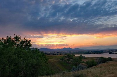
This leisurely, easygoing urban nature trail offers a lovely view of Standley Lake with foothills off to the west, as you traverse open grassland along singletrack, dirt road, and shoreline. (Optionally, one can extend one's course to continue further around the lake's western edge, near enough to view protected Bald Eagle nesting grounds on the western peninsula, from a distance.)
Other Resources Worthy of Credit and Your Reference, Describing this Trail:
https://www.alltrails.com/trail/us/colorado/south-standley-lake-trail-loop--2
https://www.hikingproject.com/trail/7074704/standley-lake-south-shore-outer-loop
https://www.trailforks.com/trails/standley-lake-south-trail-559668/
Meet at the Trailhead at 5pm. Please don't be late, since we may take a few moments to stretch, loosen up and warm up, as people feel wise for their conditioning.
Getting to the Trailhead:
Pick up the trail starting from the parking lot of Standley Lake Regional Park on the south side of Standley Lake. (See the 'Starting GPS Point' map.)
From Denver, take I-25 N to Hwy 36 to the Sheridan Boulevard exit in Westminster. Turn LEFT onto Sheridan Boulevard and IMMEDIATELY get into the right-hand lane. Go RIGHT, taking the exit onto West 88th Avenue. Continue west along West 88th Avenue all the way to Standley Lake, where it becomes 86th Parkway. Keep going west along 86th Parkway for 1 mile past the intersection with Kipling Street, to take your RIGHT-hand turn into the south parking area for Standley Lake Regional Park.
From Boulder, take Hwy 36 southeast to the town of Superior exit. Take the RIGHT-hand turn south along McCaslin Boulevard. Take the 2nd exit at the traffic circle, to keep going south until you rise up the curving hill to Highway 128 (a/k/a 120th Avenue). At the light, turn LEFT (east) and go about 0.2 mile to take a RIGHT onto Indiana Street. Continue south on Indiana 2.8 miles to West 96th Avenue. At that intersection, go LEFT (east) and continue 0.9 miles before curving/turning right onto Alkire Street. Take Alkire south again all the way to 86th Parkway, where you'll turn LEFT (east). Continue 1 mile from the intersection to your LEFT-hand turn into the south parking area for Standley Lake Regional Park.
Standley Lake
-
AllTrails
Hiking Project
DOT.org
Westminster
Trailforks
CoTrex - See full route/place details.
Required Equipment
If you personally need rehabilitation support equipment, be absolutely sure to bring it, even if it's just "in case." Walking boot, knee or ankle brace, whatever else you and your doc or your physical therapist have decided you would be wise to have available!
