Trip
Hiking – Off-Trail Series: Square Top Loop (Northwest Ridge, Class 2)
Off-Trail Series: Square Top Loop (Northwest Ridge, Class 2)
- Sat, Aug 3, 2024
- Denver
- Hiking
- Basic Alpine Climb
- Adults
- Difficult
- Difficult
- Mileage: 10.5 mi
- Elevation Gain: 4,887 ft
- High Point Elevation: 13,794 ft
- Pace: 3 mph on trail; 1,000 ft per hour off-trail
- 2 (6 capacity)
- 1 (2 capacity)
- Cancellation & Refund Policy
We will carpool from the Home Depot parking lot located at Quincy and Morrison (4277 S Eldridge St, Morrison, CO 80465) for a 5:30 AM departure. Please arrive a few minutes early to arrange carpools. Link for Google Maps.
Our hike will start at the Shelf Lake Trailhead on County Road 10 off Geneva Road (“Guanella Pass Road”). We will be hiking in the South Platte Ranger District (Pike NF) primarily within Clear Creek County. Link for Google Maps. Our goal is to start hiking at 7:00 AM.
It is suggested that all occupants of a vehicle share the costs of driving. Based on a reimbursement rate of $0.32 per mile, the total amount for the 101-mile roundtrip drive via US 285 is about $32 per vehicle. This cost typically is divided by the total number of people in the vehicle, including the driver.
This is a Difficult Hike based on the significant elevation gain, amount of off-trail travel, high elevation, pace, and terrain (Class 2). Expect a cool start with the first 3 miles on forested trail, followed by 6+ miles above timberline. We’ll see few people for much of the day.
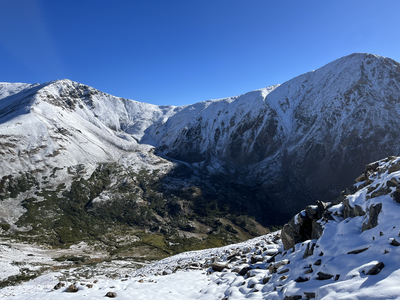
This is a less-traveled tour of Square Top Mountain that starts from the Shelf Lake TH. We’ll park at the standard trailhead and follow the trail to Shelf Lake. After a stop for water, we’ll ascend the north facing slopes and climb to Decatur Mtn (12,892’), then follow the Continental Divide until we turn to ascend Square Top by its Northwest Ridge. From there, we’ll initially follow the trail down towards Guanella Pass but then head south off-trail to pick up the South Park Trail. At that point we’ll follow the trail back to our starting point.
There are few opportunities to bail out on this trip. Your fitness, adaptation to high elevation, off-trail skills, and appropriate equipment are essential to be successful. If you’re not sure whether this trip is for you, it probably is not. Expect a long, difficult day well above timberline.
Important: This route is off-trail for 40% of the distance (4.25 miles, Class 2) and has no water access for nearly 6.5 miles (which includes all our off-trail travel and most of our climbing). This section is steep and difficult, and our pace will be relatively slow; expect approximately 8 hours total.
Recommended maps:
CalTopo - https://caltopo.com/m/0PLEQ
USFS - https://www.fs.usda.gov/psicc
Weather (Square Top): Link to weather.gov
Required Equipment
10 Essentials, and you must have capacity to carry at least 2 liters of water. (It will be helpful if you have a way to treat/filter water on the trail, or seriously consider bringing 3 liters of water.)
