Trip
Hiking – Mount Neva, 12,814 ft, Northwest Ridge Route.
Mount Neva, 12,814 ft, Northwest Ridge Route.
- Tue, Sep 26, 2023
- Pikes Peak
- Hiking
- Adults
- Challenging
- Mileage: 9.6 mi
- Elevation Gain: 3,300 ft
- High Point Elevation: 12,814 ft
- Pace: 2.0 mph
- 5 (8 capacity)
- Cancellation & Refund Policy
Junco TH, at 10,050-ft, at 7:30.
From the town of Winter Park Colorado, go north a few miles to the tiny town of Frasier. From Frasier continue north about 3 miles to a turn off on the right (Meadow Creek Reservoir). There should be a clearly marked sign for Meadow Creek Reservoir here. Follow the road 9 miles to Meadow Creek Reservoir. This road is paved for the first half mile then turns into an improved dirt road, suitable for passenger cars. There are many unofficial campsites along this nice dirt road, which I recommend if you are planning on driving up for the night. The road gets rougher about 5 miles into it. There is also a fee station that takes credit cards at about mile 6; the cost for the day is $5.00. Once you have arrived at Meadow Creek Reservoir, you can clearly see Mount Neva and its huge west face off to the south. Continue around the reservoir on a good road for about another 1.5 miles to the signed Junco Trailhead at 10,050-ft
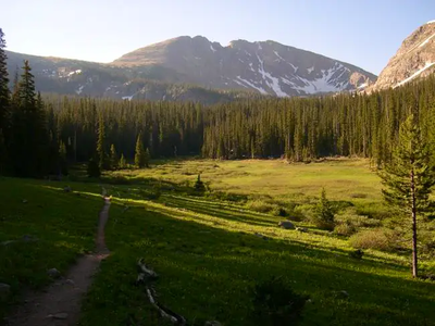
Starting at the Junco TH at 10,050-ft follow the wide “Caribou Pass Trail” trail as it slowly ascends up through the trees and bypasses some beautiful meadows on the right. Mount Neva’s huge west face will never leave your view for the entire hike up to the lake, so getting lost would be difficult, since your objective is Columbine Lake. After about 2 miles of easy hiking, you will come to a fork in the trail. There is a sign marking the Columbine Lake turn-off. Leave the wide Caribou Pass Trail and turn right on the single-track trail to Columbine Lake. Follow this trail another mile through some delicate wetlands and on to Columbine Lake. During this stretch, Point 11,831 will be the towering cliffed-out mountain on your right and Mount Neva will be directly in front of you.
Once at the lake, locate the saddle connecting point 11,831 and Neva’s northwest ridge. Follow the trail around to the south side of the lake. From the lake head south where there is a faint trail that is hard to find at first,but is visible as it ascends the grassy slope all the way to the saddle. This section of the trail is beautiful with all the large boulders throughout the marsh. Follow the trail up the switchbacks to the saddle. From the saddle start your ascent up Neva’s steep, talus-laden northwest ridge. The trail is faint and disappears frequently. The terrain is a mix of large boulders, loose rock and scree. At first the ridge is quite steep, requiring a little route finding to bypass some steep walls of rock. After the initial half-mile of tough class 2 hiking the degree of difficulty relents to a leisurely stroll up grassy slopes. Scramble over a few more large boulders to get to the summit of Mt. Neva where the views are terrific!
Leader's Note - The leader has not done this hike before, expect a little adventure.
Historical note – Mt. Neva was named by Ellsworth Bethel, a botany teacher from Denver, who was concerned over the naming of the mountains and thought it should be named for an Arapaho Indian.
Required Equipment
tk
