Trip
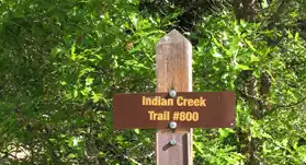
Hiking – Indian Creek Trailhead - Indian Creek Trail
A moderately difficult, casual-paced, 8-mile hike along the Indian Creek Trail (#800) towards the turn-around point at "Lenny's Rest" intersection with the Colorado Trail (#1776). Starts and ends at Indian Creek Trailhead. 1,700 ft elev gain
- Sat, Apr 22, 2023
- Pikes Peak
- Hiking
- Families
- Moderate
- Moderate
- Mileage: 8.5 mi
- Elevation Gain: 1,707 ft
- High Point Elevation: 7,360 ft
- Pace: 1.5-2.0mph
- FULL, 2 on waitlist (9 capacity)
- Cancellation & Refund Policy
Indian Creek TH to Lenny's Rest and Back. A moderately difficult, casual-paced, 8-mile out-n-back "lollipop" hike along the Indian Creek Trail (#800) with pine forests, open meadows, occasional mountain views, and 1,707' of elevation gain towards the turn-around point at "Lenny's Rest" intersection with the Colorado Trail. Starts and ends at Indian Creek Trailhead. Trip Leader's Map: https://caltopo.com/m/BE1K4
Overview. This is a CASUAL paced spring hike in Colorado which may mean snow, ice, mud, or a dry trail. 8-miles roundtrip / 1,707 Elev Gain. Watch the weather and adjust your gear and footwear appropriately. Plan on plenty of stops for photo ops, catching your breath, enjoying the scenery, snack and water consumption, and gear/layer adjustments. If this is not your hiking style - please do not sign up.
Hiking Plan. This is a Lollipop trail hike - a route with a loop at the end of an out-and-back start/finish. The plan is to hike north from the Indian Creek TH along the trail to the intersection with the Colorado Trail at Lenny's Rest (about 4 miles)for a snack break. Then back south to the Indian Creek TH via a slightly different route before rejoining the main trail.
No Pets.
We will travel as a group and observe the Principles of Leave No Trace, especially :
-Travel on durable surfaces (stay on the trail)
-Dispose of waste properly
-Leave what you find
-Respect wildlife
-Be considerate of other visitors
- Trip Specs. Rated "Moderate" by the CMC due to elevation gain.
- Distance: 8.05mi, Elev range: 6372' to 7360', Elev Gain +1707'
- "Moderate" hiking trips have up to 12-miles round-trip OR up to 2,500' elevation gain.
- "Easy" hiking trips have up to 8 miles round trip OR up to 1200' elevatiopn gain
- Review the Trip Difficulty Ratings at https://www.cmc.org/education-adventure/trips/trip-difficulty-ratings
More Trail Info
https://trails.colorado.gov/@thetaylerclark/trips/118538
https://coloradotrail.org/wp-content/uploads/2020/06/Seg1MapIndianCrkAltIndianCreekAlternativeReducedFilesize20200601.pdf
https://coloradotrail.org/traveling-the-ct/dogs/
Weather Forecast https://forecast.weather.gov/MapClick.php?lon=-105.11456966400146&lat=39.3922175803811
Questions about the hike? Email Glenn at gjb2000@gmail.com
We will meet at 8:00am at the Indian Creek Trail Parking Lot for an equipment check and trailhead briefing.
Google Map: https://goo.gl/maps/2Tb5rRRSGXMjZeFA7
There is a parking fee ($10 per vehicle) for day use (as of Apr 22, 2023)
TH info https://www.fs.usda.gov/recarea/psicc/recarea/?recid=12953
Required Equipment
10-essentials - all of them
Appropriate footwear / winter traction for the conditions
Trekking poles if desired
