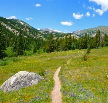
Trip
Hiking – Hessie TH - High Lonesome Loop Hessie Eldora 16mi 3300 gain
This is a variation on the “standard” loop which, at 17 miles and 4,600 feet of elevation gain, adds a couple of miles and extra 1,000’ of elevation. Expect a Difficult hike based on the significant elevation gain, high elevation, pace, and terrain. This can be a very busy trailhead and there is no shuttle service on Tuesday’s, so we’re looking for a fairly early start.
- Tue, Aug 20, 2024
- Denver
- Hiking
- Adults
- Difficult, Difficult D
- Difficult
- Mileage: 17.0 mi
- Elevation Gain: 4,600 ft
- High Point Elevation: 12,627 ft
- Pace: 2,.8
- 2 (6 capacity)
- 1 (2 capacity)
- Cancellation & Refund Policy
This 17-mile variation of the High Lonesome Loop adds a couple of miles and more than 1,000’ of additional elevation gain to the “standard” loop. Expect a cool start with the first 5 miles on forested trail, followed by approximately 7.5 miles above timberline before getting back into the trees.
We will hike clockwise, passing King Lake on our way to the Continental Divide. We’ll then head north, past Devil’s Thumb before descending via Storm Lakes to Jasper Lake. This descending section is much less traveled than other sections of the route and the scenery is impressive.
There is water access at several points, so your choice is to filter/treat water as we hike (please bring minimum 2-liter carrying capacity) or carry from the trailhead (minimum 3-liters, more may be needed).
We will gain roughly 4,600’ on the day and much of the route is above timberline. Please bring your 10 Essentials, including appropriate clothing for sun, rain, wind, etc. Expect the temperature at 12,000’ to be at least 25 degrees cooler than the Front Range; wind chill may make the temperature feel even cooler/colder.
Although the trailhead can be very congested, the crowd thins out with distance and elevation. We should avoid the heaviest crowds since this is a weekday.
This hike is anticipated to take 7-8 hours to complete, although our actual time may be different based on weather, strength of the group, and other factors.
If you’d like more info about the route, please check out the links below. This route travels primarily through the Indian Peaks Wilderness within the Boulder Ranger District in Roosevelt National Forest.
More Information:
Weather: weather.gov for Devil’s Thumb Pass
Map: CalTopo
Trail info: Hiking Project
Trail info: 10 Adventures
*** EDIT 8/18: THE MEETING TIME AND LOCATION HAVE CHANGED DUE TO WEATHER FORECAST. PLEASE READ THE PRE-TRIP EMAIL FOR DETAILS.
We will carpool from CMC located at 710 10th Street, Golden, CO 80401 for a 5:30 departure. Please arrive a few minutes early to arrange carpools.
Our hike will start at the Hessie Trailhead near Eldora. Link for Google Maps. Our goal is to start hiking around 6:45 AM.
CMC suggests that all occupants of a vehicle share the costs of driving. Based on a reimbursement rate of $0.32 per mile, the total amount for the 68-mile roundtrip drive via Coal Creek Canyon (CO-72) is about $22 per vehicle. This cost typically is divided by the total number of people in the vehicle, including the driver.
Required Equipment
10 essentials (including sun protection, rain jacket, and 2-3 liters of water; additional water available on route if you choose to filter)
