Trip
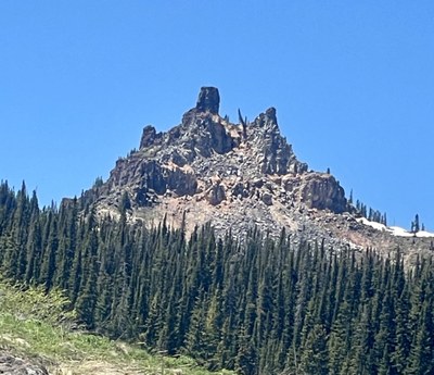
Hiking – Castle Peak
Castle Peak 11,240
- Tue, Jun 20, 2023
- Gore Range
- Hiking
- Adults
- Difficult
- Mileage: 7.0 mi
- Elevation Gain: 1,800 ft
- High Point Elevation: 11,240 ft
- Pace: 1.5 mph average
- $50.00
- 5 (9 capacity)
- Cancellation & Refund Policy
Castle Peak is the namesake for the Castle Peak Wilderness Study area north of Wolcott, Colorado. This trip is considered exploratory as the leader has not been there, and research indicates that the trail is not well maintained and has areas of downfall along the way. Depending on how far down the road we can drive, the distance ranges from 7 - 8 miles with an elevation gain between 1700’ and 2000’. Due to unknown conditions, please plan for a long day and various weather types.
By signing up for this hike you agree to have your e-mail address shared with other participants and photos of you shared in Facebook or other media.
If you need to cancel, please use the appropriate method to cancel on the CMC website - do NOT contact leader. If you have to cancel the morning of the trip, please TEXT the leader at 303-888-0559 by 6:00 am.
If you have any known medical conditions that may manifest themselves during this activity, please notify the leader via e-mail prior to the trip.
If you have known exposure to a COVID-positive case within 5 days of this trip, please do not come. Do not come if you are sick. Contact Leader to cancel.
NO PETS please!
Meeting time 6:45 at the Frisco Kayak Parking lot.
Driving time approximately 1.5 hours.
From Wolcott, CO, go north on Colorado 131 about 3 miles and turn left (west) on Milk Creek Road. Proceed about 8 miles to the trailhead, on the right by the power line. The trail follows an old jeep trail running northwest.
Required Equipment
The 10 essentials, including your own first aid kit and raingear.
