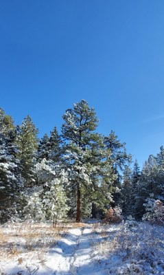
Trip
Hiking – Carhart Trail
Easy loop hike: Carhart trailhead to Archery range to Northridge to Devil's Canyon back to Northridge trail crossover to the Carhart trail and out. This loop is about 2.25 miles with approximately 130 ft elevation change. Easy up and down rolling terrain with some rocky areas and waterbar or rock steps.
- Sat, Nov 2, 2024
- El Pueblo
- Hiking
- Adults, Families
- Easy to Moderate
- Easy
- Mileage: 2.25 mi
- Elevation Gain: 130 ft
- Pace: 1.0 to 1.5 mph
- 10 (10 capacity)
- 1 (2 capacity)
- Cancellation & Refund Policy
This is an easy hike to be held prior to the CMC El Pueblo Group Picnic, see calendar announcement for picnic details. Meet at 9:15 for a 9:30 start at the PMP Carhart trail parking area. The hike will begin and end at the Carhart trailhead.
The trailhead is accessed off of Highway 78/S Pine Dr. (changes names) in Beulah Valley west of Pueblo. From Highway 78 (S Pine Dr.) turn right onto Pueblo Mountain Park Road, stay right to the archery range parking lot. If you reach the main entrance to the park you've gone one road too far. An easy way to recognize the turn for Carhart is that it's the next road just past the sign that says "Pueblo Mountain Park 1/2 mile."
Separate carpool arrangements may be made, but participants need to consider whether all riders will be staying for the picnic.
The pace set will be dependent upon the group participants. Please be prepared for a slow, relaxed pace and time spent below the Devil's Canyon Pour-off. This is a family and leashed, well-behaved dog friendly hike. Great for beginners and those new to the area. If I have not had the pleasure of meeting or hiking with you, please contact me before signing up.
Bring a chair, BYOB, and something to share and stay for the CMC El Pueblo Potluck Picnic after the hike!
Required Equipment
A weather update will be provided a few days prior for those registered. The ten essentials, a liter of water, solid hiking shoes/boots are required. Poles may be desired by some due to the rocky, uneven terrain in some areas of the trail, especially near the Devil's Canyon Pour-off.
