Trip
Hiking – Bison Peak via Ute Creek Trail
- Tue, May 27, 2025
- Bobcats Section
- Hiking
- Adults
- Difficult
- Difficult
- Mileage: 12.0 mi
- Elevation Gain: 3,850 ft
- High Point Elevation: 12,431 ft
- Pace: Moderate (2.0 avg moving speed)
- 7 (7 capacity)
- Cancellation & Refund Policy
Meet at the Morrison Park and Ride (“PnR”) at 6:15am, so we can form carpools and leave no later than 6:30am. The “Morrison PnR” is at the northwest corner of the Morrison Road exit off C-470. Here’s a Google Maps link to the “Morrison PnR”: https://maps.app.goo.gl/mpG84vtWp2eCEGxU8
We will be starting at the Ute Creek trailhead. This is on County Road 77, 21 miles south of Jefferson off of US285. Here’s a Google Maps link to the “Ute Creek Trailhead”: https://maps.app.goo.gl/QKkREhDkDbdWNPG98
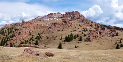
This is an out and back hike, with a lot of elevation gain and distance. Most of this trail is on established trails, the Ute Creek and Brookside McCurdy Trails. However, the 1.8 miles roundtrip from an unnamed pass to/from Bison Peak is off trail, specifically hiking on tundra among some rock towers. There is some Class 2 scrambling at the summit.
Here is a link for the Bison Peak via Ute Creek Trail in AllTrails: https://www.alltrails.com/trail/us/colorado/bison-peak-summit-trail
Required Equipment
Bring your 10 essentials. Additional required equipment may be specified in the pre-hike email.
