Trip
Hiking – Ben Tyler Trail
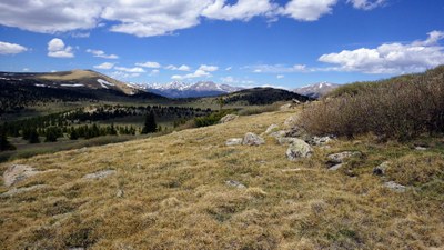
Shawnee Peak from the BILL TYLER trail not the BEN TYLER trail.
- Sun, Nov 10, 2024
- Bobcats Section
- Hiking
- Adults
- Moderate C
- Challenging
- Mileage: 8.0 mi
- Elevation Gain: 3,800 ft
- High Point Elevation: 11,927 ft
- Pace: Moderate
- 6 (5 capacity)
- Cancellation & Refund Policy
Meet in Conifer at 6:45am for a 7:00am departure. More specific details in the pretrip logistics email.
Weather and snow conditions permiting, we will do an off-trail hike up Shawnee Peak. For this particular area the off-trail portion may be tricky. This hike is for the more experienced off-trail hikers due to steep terrain and shrubbery.
If weather/snow conditions suggest Plan B instead, we will hike the BEN TYLER trail to the Foster BM.
This is also a smartphone navigation hike. Please import the GPX file into your preferred smartphone navigation app. The GPX file will be sent to all trip participants as part of the pre-departure logistics email.
With off-trail hikes it is difficult to navigate and routefind by sight, while using a map and compass is typically a time consuming and error-prone activity. Navigating by smartphone is usually the most effective way to reach our destination, then safely return to the TH. It is an essential tool should someone get separated from the group. Not perfect but the best we have so far.
Required Equipment
Winter weather gear, trekking poles, and microspikes as well as the GPX file preloaded in your smartphone. Depending on temperature, please ensure your water doesn't freeze.
