Trip
Bike – Mineral Belt Trail
Mineral Belt Trail x2
- Thu, Sep 7, 2023
- Denver
- Biking
- Youth, Adults
- Easy
- Moderate
- Mileage: 11.6 mi
- Elevation Gain: 750 ft
- High Point Elevation: 10,240 ft
- Pace: moderate
- 5 (5 capacity)
- 2 (2 capacity)
- Cancellation & Refund Policy
https://www.traillink.com/trail-maps/mineral-belt-trail/
Elevation Gain: 9,900′ – 10,600′
We have a couple of TH starting points to choose from: 1) 999 1/2 US-24, Leadville or 2) 100 County Rd 11, Leadville. 3) 1199-1035 Elm St, Leadville
Meet at Wooly Mammoth, Section BB. Wooly Mammoth.. Let's meet at 7:30 for immediate departure. From Wooly, it's about 1.5 hrs to Leadville.
Let's meet about 9:15 am at the paved parking lot off of McWethy Drive by the west end of the trail. Attached is a pdf of the route.
After traveling the loop in one direction, we’ll turn around and travel to the point of beginning.The path is paved. Please arrive with plenty of water. With the slight grade, we’ll probably go at 10-12 Mpg and finish up at 12:30 or 1 pm.
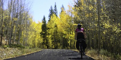
ABOUT THE TRAIL: The majority of the trail is estimated to be in the mostly gentle grade category (5% or less) but there are steeper sections at about 3.5 and 5.0 miles when going counterclockwise. 11.6 mile asphalt path that is replete with history, scenery, and recreation. The riding is smooth and the educational opportunities are bountiful. Set in Colorado mining country, the trail is dotted with historical signs and remnants of a rich geological past. When it is hot down in Denver and Boulder, it is often cooler up in the higher elevations of Lake County. Views of the Collegiate Peaks and Colorado's highest peak of Mt. Elbert are plentiful from the trail.There are benches and picnic tables along some of the route for resting. This trail is perfect for railroad buffs, mining fans, and history aficionados. After a leisurely bike ride or stroll on the trail, the town of Leadville offers numerous restaurants, antique stores, and museums.
There’s a post ride lunch in option Leadville. It received good reviews..HIGH MOUNTAIN PIES 4.7 STARS. (2.2K) $$ KNOWN FOR THEIR PIZZAS, CALZONES AND SANDWICHES.
Carpool mileage Rt from wooly Mammoth to leadville is 176 miles x $.35/mile = $61 divided by the number in the vehicle.
Required Equipment
The Rail - Trail is paved.
The 10 essentials. Additional layers because it can be cool and/or windy
