Trip
Backpack – Zirkel Circle via Slavonia Trailhead
Backpacking Section - Hike 10 miles around the stunning Zirkel Circle, camping at a different lake each night.
- Fri, Sep 2, 2022 — Mon, Sep 5, 2022
- Backpacking Section
- Backpacking
- Adults
- Easy
- Easy
- Mileage: 10.4 mi
- Elevation Gain: 2,400 ft
- High Point Elevation: 10,765 ft
- 2 (7 capacity)
- Cancellation & Refund Policy
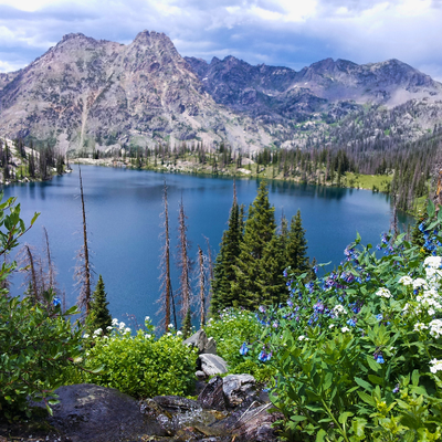
Itinerary: Revel in flower filled meadows, crystalline lakes, and stunning views of the Continental Divide on a 10.4mile journey that follows the rushing waters of Gilpin and Gold Creeks to reach each lake. The first 2 days are a steady climb to Gilpin Lake followed by 2 days of gradual descent.
- Day 1: Drive to Slavonia Trailhead (approx. 3.5 hrs from Golden). Pit toilets. Start hike on the Gilpin Trail #1161 and keep left to stay on Gilpin at the fork with the Gold Creek Trail (#1150). You will be hiking clockwise along Gilpin Creek. Continue a gradual ascent for 2 miles/ 927ft and find camping in the meadows along the creek.
https://trails.colorado.gov/routes/38270?t=m4WoaQXdGZBEtibHopnL - Day 2: Continue hiking the steady ascent up to Gilpin Lake Trail. Reach the lake after 2 miles/ 1000ft and find camping at least ¼ mile from the lake.
https://trails.colorado.gov/routes/38271?t=uuZ3Pd8JSDg5faKtfq9U - Day 3: Continue on the trail up a ridge (about 400ft up) and look back for a stunning view of Gilpin Lake. Continue and come to the junction with the Gold Creek Lake Trail #1150.1. Turn right here and continue downhill to Gold Creek Lake (keep right at the junction with Wyoming Trail #1101.1). Find camping at least 1/4mile from the lake. Total 3 miles/ 467ft ascent / 1,238 descent
https://trails.colorado.gov/routes/38272?t=izLBMEytjRZIPsqE7no3 - Day 4. Complete the Zirkel Circle by continuing on the Gold Creek Lake Trail back to the TH. This final 3 miles is virtually all downhill along the creek, 3 miles /1,125 descent.
https://trails.colorado.gov/routes/38273?t=J3W8ci3PwDwBhAOEgpGG
General Requirements: Camping must be at least ¼ mile away from Gold and Gilpin Lakes
Maps: https://trails.colorado.gov/routes/38275?t=AR7RKdyNHuVXNsoqZpPP
Meeting location and carpooling info will be provided via email prior to trip date.
Driving Directions: From West of Steamboat Springs, take Hwy 40 about 2 miles and turn right onto County Road 129. Travel north about 18 miles to the Seedhouse Road (NFSR 400; also CR 64) and turn right. Continue for about 11 miles to the end at the Slavonia Trailhead parking area.
Note: the Slavonia TH is very popular to plan accordingly to secure parking. If you want to arrive the night prior, dispersed camping is available on the road to the TH.
Required Equipment
TK
