Trip
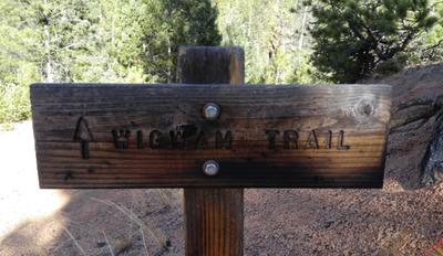
Backpack – Wigwam Park via Wigwam Trail
Beginner backpacking trip (1-night) along the Wigwam Trail in the Lost Creek Wilderness primarily for recent graduates of the PPG WTS-Intro to Backpacking Class. Rated Moderate. 4.1-miles uphill one way / 1,541 elev gain.
- Sat, Jun 22, 2024 — Sun, Jun 23, 2024
- Pikes Peak
- Backpacking
- Adults
- Moderate
- Moderate
- Mileage: 8.2 mi
- Elevation Gain: 1,541 ft
- High Point Elevation: 9,641 ft
- Pace: 1.5-2.0
- 1 (6 capacity)
- FULL (3 capacity)
- Cancellation & Refund Policy
Meeting. We will meet at 9:30am at the Wigwam TH #609
Google Map https://goo.gl/maps/L97GgZMhLRTKZ4yx8
Wigwam Trailhead (8,160 ft. elevation). Located at the end of a short spur road off the Stoney Pass Road (Forest Road 560). Take Forest Road 211 from County Road 126 west of Deckers. At the "Y" junction of Forest Road 211 and Forest Road 560, go right on 560 to the trailhead road (Forest Road 545).
There are no toilets or porta-potties at the TH.
Be sure to secure your vehicle and hide any valuables from sight.
This is a 1-night BEGINNER backpack - with time spent reviewing and reinforcing skills relating to carrying loads, selecting campsites, purifying water, storing food, cooking food, and evaluating the terrain and mitigating hazards to enjoy the outdoors safely while traveling self-supported in the backcountry.
The plan is to hike from the Wigwam TH along the Wigwam Trail to Wigwam Park and slightly past to the intersection with the Rolling Creek Trail and spend the night and then return.
Leave No Trace. We will travel as a group and observe the Principles of Leave No Trace, especially :
-Travel on durable surfaces (stay on the trail)
-Dispose of waste properly
-Leave what you find
-Respect wildlife
-Be considerate of other visitors
Moderate Rating. This trip is rated "Moderate" per the CMC difficulty rating due to more than 1,000-ft of elevation gain in a day. https://www.cmc.org/education-adventure/trips/trip-difficulty-ratings#backpack
Trip Leader Caltopo Trail Map: https://caltopo.com/m/3B3E
Roundtrip Distance: 8 miles, elev range: 8122' to 9641' : +1541' -69'
Trail Info
Forest Service https://www.fs.usda.gov/recarea/psicc/recreation/recarea/?recid=13004&actid=51
All Trails https://www.alltrails.com/trail/us/colorado/wigwam-trail-609
Friends of Mount Evans and Lost Creek Wilderness https://fomelc.org/trails/wigwam
Hiking Project. https://www.hikingproject.com/trail/7029138/wigwam-trail-609
Permits and Wilderness Regulations There is a mandatory self-issuing permit system in the Lost Creek Wilderness areas to enable Forest Service to better manage visitation. Wilderness Regulations Apply https://www.fs.usda.gov/detail/psicc/specialplaces/?cid=stelprd3795315
Required Equipment
Participants must provide their own 10 essentials and backpacking gear needed to safely and comfortably travel, sleep, cook, eat, purify water, and enjoy an overnight camping adventure.
Check the weather for temps and likelihood of precipitation and pack accordingly.
Expect biting bugs - we will be traveling by and camping near water
The Ultimate Backpacking Checklist by Benjamin Tepler, March 19, 2022
https://www.backpacker.com/gear/the-ultimate-backpacking-checklist/
